
Empowering Conservation Through Training and Technology
We work with National Parks and UNESCO World Heritage Sites to deploy advanced surveillance and park defense systems to ensure “No Cut, No Kill” protection for wildlife and ecosystems.
Global Park Defense:
An Overview

Global Park Defense (GPD) increases ranger patrol and park protection effectiveness in critical ecosystems. GPD is a scalable system with technology and training tailored to each park, dramatically increasing the effectiveness of rangers and park authorities to protect their world heritage.
Selection Criteria
We are highly selective in choosing the projects that we support. In order for us to implement Global Park Defense, the site must meet the following criteria:
Be an endangered national park or UNESCO World Heritage Site in a developing country.
Contain critical habitat for megafauna with intact, primary ecosystems.
Have a highly motivated and well-staffed park authority, possibly with collaboration from proven local NGOs.
Have a park authority willing to commit to the Global Park Defense goal of “No Cut, No Kill”, and be willing to fund park border demarcation and communications towers.
Show excellent potential for sustainable tourism to support permanent protection.
The Four Stages of Global Park Defense

1. Planning
Threat assessment, security, and surveillance design, ranger deployment strategy. Before we can begin a Global Park Defense program, it is critical to have a thorough understanding of the threats. Our first step is to conduct a threat assessment as well as scientific baseline surveys of wildlife populations, which help us to track our progress. We then put together a detailed security and surveillance plan, as well as a strategy for ranger deployment.
2. Partnerships
Wildlife and forestry, government, telecommunications, and co-funding. Global Conservation brings critically important co-funders, government and private investment, and strategic partners to assist in conservation finance, park infrastructure and communications, scientific research, and community-led tourism.
3. Protection
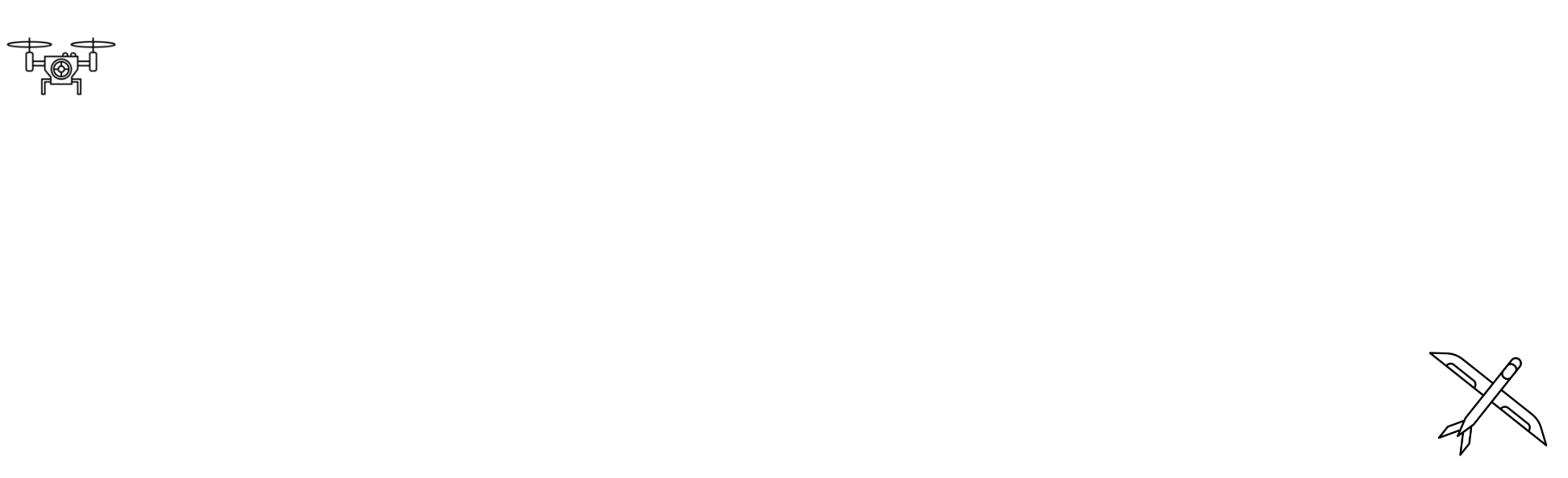
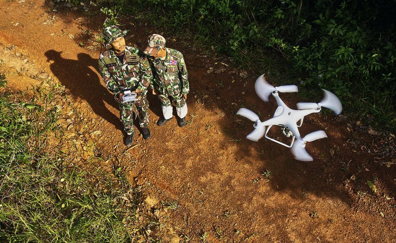
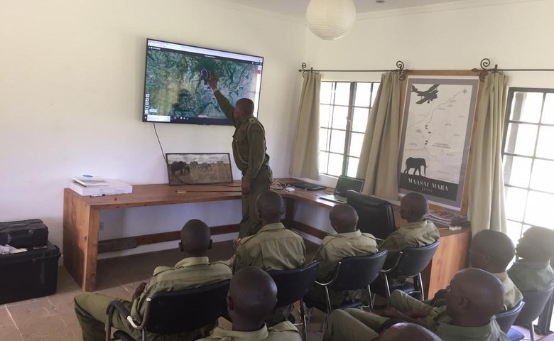
Community involvement, law enforcement, and military support. Armed with Global Park Defense, rangers are spotting and apprehending more wildlife and timber poachers in the world’s most endangered parks. Under GPD, government rangers, community Eco-Guards, and sometimes military and police join forces on park protection. These collaborative teams use state-of-the-art tools, like EarthRanger of Ai2, SMART patrolling systems, and drones to intercept criminal activity and stop poaching and logging before it becomes severe.
4. Sustainability
Governmental budgeting, tourism revenues, and park financing. Global Conservation assists in securing long-term financing to fund park and wildlife protection after our multi-year Global Park Defense projects end. Each Global Park Defense deployment requires US$400-500,000 over 5 years for training, equipment, and communications systems. Global Conservation requires national governments to increase the number of salaried park rangers and pay all salaries, benefits, and insurance. Meanwhile, we bring together critically important co-funders, government and private investment, strategic partners, and carbon offset financing to assist in long-term conservation finance, park infrastructure and staff, communications, scientific research, and community-led tourism.

Metrics for Measuring
Global Park Defense Success
-
We measure the number of alerts from the first day that cellular trail cameras are installed. If there are already existing camera traps, we note the number of alerts to date so that we have a baseline. In all cases, we check progress every six months to compare to the previous six months.
-
It is important to keep accurate records of kilometers patrolled for a few reasons. Firstly, since we aim to increase the number of patrols, we need a baseline. Secondly, it’s also important to eliminate unnecessary patrol kilometers in areas without criminal activity. Finally, patrolling is also used to measure efficiency. If kilometers patrolled have decreased, but arrests and interdictions have increased, we know that we are patrolling more efficiently. We also want to differentiate and analyze the effectiveness of vehicle vs. foot patrols.
-
Interdictions need to be analyzed to establish which of our methods are the most effective. We must keep track of the number of encounters when on patrol vs. interdictions that result from informant tips or camera alerts, etc. Overall interdiction numbers are then compared to the number of resulting arrests and convictions.
-
Tracking the number of arrests and confiscations is important because it gives us the percentage of interdictions/encounters that result in arrests for criminal activity. Confiscating guns, chainsaws, carcasses, drugs, or snares has an impact even without arrests. All confiscated items need to be documented and inventoried for possible future court cases and to monitor the extent of illegal activity.
-
Stops and arrests will not have the intended impact if the legal system is failing. Convictions give us a measurement of government efficiency and corruption and give us the opportunity to identify and change outdated laws and obstructions in the legal system. As an example, if many convictions result in small fines and minimal jail time, we know we need to reexamine the structure of the laws pertaining to wildlife protection.
-
The media plays a big role in reducing crime, especially when laws are weak. The media can expose criminals within and outside of the community and make people aware of the issues. It also flushes criminals out of hiding and puts added pressure on family, friends, the community and even other criminals to give information. Other criminals do not want media attention and scrutiny in an area where they may also commit crimes.
-
Tracking wildlife populations over time is an excellent way to assess progress, as well as to detect illegal activity. When we begin a GPD project, we start with a baseline wildlife population assessment. Then, we can compare all future assessments to that baseline to determine whether our conservation efforts are proving successful. If we detect a sudden change in a species’ population, it may indicate increased poaching pressure, an increase in indirect impacts such as logging, or a landscape-scale change such as fire, pollution, or a natural disaster. Knock-on effects can happen, too -- a drop in predator numbers will often cause a rise in prey animal species. Once we detect such a change, we can start searching for the cause.
Quick Tips for Kick-starting a Global Park Defense Program
-
Do not initiate your GPD plan without doing your own investigation of known and potential threats in the area first. Be thorough in your initial threat analysis; oftentimes, problems on the ground are a product of a greater root issue that needs to be addressed.
-
Communication is the most important factor in rolling out a GPD plan. All relevant governmental and non-governmental parties must be on board before moving forward, otherwise, unforeseen issues will likely arise.
-
Assign responsibility for the following: Lead Ranger for the field; Camera Team responsible for relocating trail cameras; Communication Center manager; Mapping and GPS; Project Manager.
-
Only a select group of personnel should know and have access to camera locations. This cuts down on possible corruption, and narrows the investigative field should you have to perform an internal investigation.
-
The Command Center is off-limits except for vetted personnel involved directly in the program launch.
-
GPS units are to remain on at all times in the field to leave a digital footprint and record of all incidents and distance traveled.
-
Camera traps can be set at ground or treetop level, either hidden or purposely visible as a deterrent.
-
Camera traps should be placed in strategic locations. Chokepoints, water sources, ridgelines, trail convergences, and of course sites of previous illegal activity are all good places to start when selecting camera locations.
-
Cameras should always be placed in groups of no less than 2. Each camera should be within the field of view of another camera. Typically, 4 to 5 cameras will be placed in a selected area to cover alternate routes, all possible navigable directions, and other cameras
-
Cameras themselves can be used as bait to catch thieves, vandals, and criminals. Set up a poorly hidden camera in a location that can be monitored by surrounding hidden cameras to catch people tampering.
-
The local community is usually your best source of information, so start to build a relationship with locals and make it beneficial for them to share information with you.
-
Patrolling data must be logged in a timely fashion in order to draw an accurate map of problem areas vs. areas that may demand less attention.
-
After year one, all patrolling should be based on the data entered into the SMART system in order to minimize wasted man hours and maximize manpower.
-
Rangers should patrol in groups of at least four when possible but never less than three.
-
Always establish a point man or woman before any patrol or spontaneous interdiction. This could be the longest-tenured ranger, by rank, or simply by rotating schedule, but must always be established before patrolling.
-
Patrols should be done in a single staggered (left to right) line but can be single file at times.
-
Always cover the side you are staggered to. The point man looks forward, while the second man is staggered left and therefore covering the left. The third man is staggered to the right, covering the right, and the last man covers the back regardless of the side he is staggered to.
-
Patrols should be done as quietly as possible and hand signals should be used whenever possible.
-
When responding to an alert, identify all possible escape routes in that corridor and block them off so that the reaction team can move in.
-
When multiple units are responding, all units must know the location and direction of approach of all other units. If rangers deviate from said route, the command center and other units on-site must be immediately notified to avoid friendly fire.
-
When making contact with suspected or potential criminals, gather as much information as possible to be entered into the database. This includes name, address, date of birth, and photos whenever possible.

FREE DOWNLOAD
Global Park Defense Manual

Global Park Defense:
Plan of Action
With Global Park Defense, the park authority and ranger teams will have increased capacity and improved effectiveness to escalate park and wildlife protection, law enforcement, and biodiversity monitoring. Our goal is to achieve “No Cut, No Kill” protection for each park/World Heritage Site within five to six years.
We use technology and training to fill the void created by a lack of personnel and resources, increasing the effectiveness of park rangers and conservation managers.
Working directly with park authorities, local communities, park ranger teams, law enforcement, and the military, we deploy an integrated program that involves Threat Assessment, a Solutions and Protection Plan, System Deployment, an Annual Evaluation of Progress, and finally an Exit Strategy.
Threat Assessment
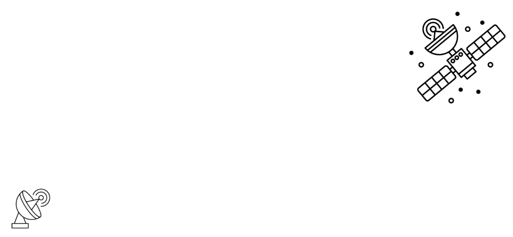
Global Conservation begins with a detailed Threat Assessment. We work with leading experts to identify the most threatened wildlife and core habitats. This assessment combines local knowledge and community inputs with data gathered from cellular trailcams, satellites, drones and advanced mapping.
Solutions and Protection Plan
Every national park or protected area will have problems unique to its flora and fauna. Protecting ecosystems on two different continents will likely call for greatly different approaches. Although equipment and general technique will be the same, the approach and implementation will vary. We create a plan that most benefits that area and gives us the best opportunity to achieve our goals for protection, conservation, and sustainability.
System Deployment
It is important that all rangers, tech support personnel, and management are trained on equipment before it is deployed. Areas of interest need to be identified and logged to determine locations for surveillance equipment, patrol and maintenance routes, and nearby trails.
Annual Evaluation of Progress
In order to measure the success of our Global Park Defense system, we must establish a baseline. We first determine what the statistics are for the area we are targeting during the “Threat Assessment” phase. We then do an initial evaluation at six months and a yearly review to track progress. We analyze relevant photos, interdictions, arrests, and prosecutions. Proper adjustments in strategy will then be made based on the data collected during the evaluation and review phase.
Exit Strategy
Sustainability is a major factor when selecting a project. It is important that we develop a plan to ensure sustainability once we complete a successful Global Park Defense set-up and implementation project. The Global Park Defense strategy is a low-cost, highly effective program if deployed correctly and can be sustainable, even in underfunded parks, with proper planning. This often involves leaving a revenue stream and funding structure in place to support the project upon our exit.

Global Park Defense:
Components
-
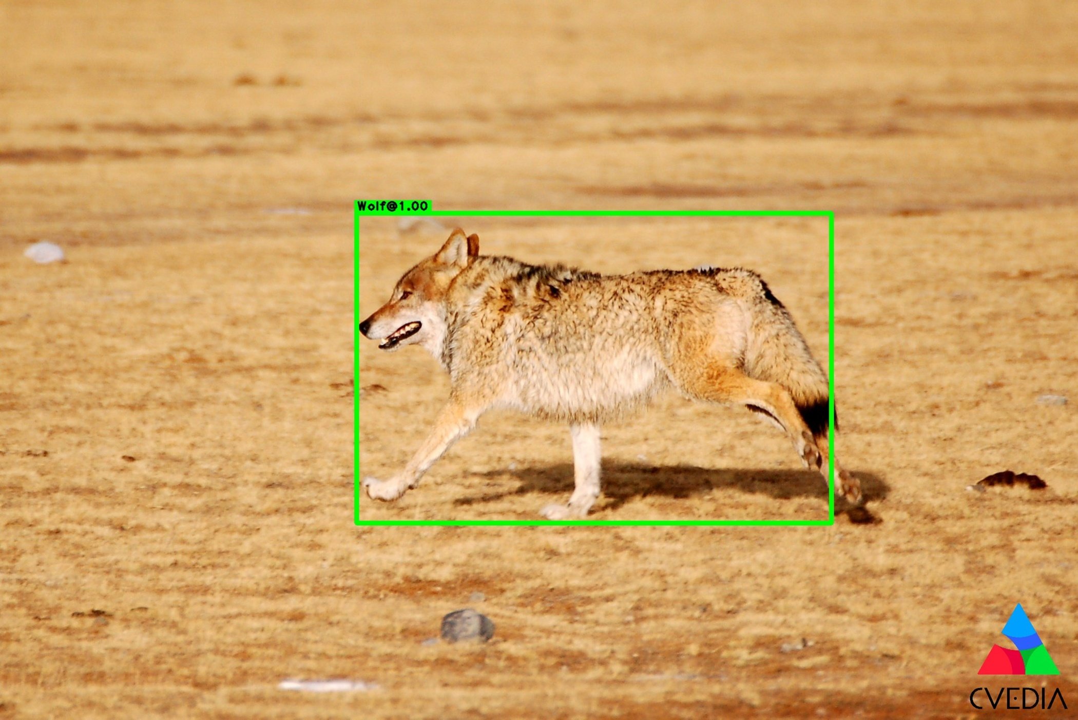
Less than 1% of criminals are caught in the act of a crime. Monitoring remote and high-crime areas provides valuable information for investigations. Much as CCTV cameras protect cities, airports and shopping malls, Global Park Defense monitors all roads, trails and rivers known for illegal activities. By providing real-time alerts about illegal intruders, rangers can rapidly respond and make arrests.
-
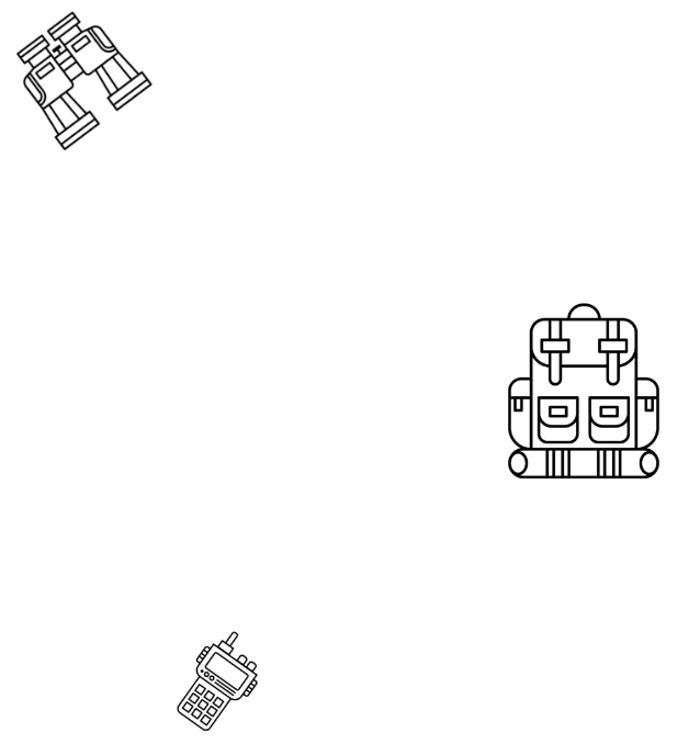
Global Park Defense provides park rangers with the necessary tools for targeted patrolling, focusing on forward bases and rapid response units in core threat areas. In many protected areas, the lack of an efficient communications system hinders timely response to threats, and can be dangerous for rangers that are unable to call for backup or medical assistance. In many remote areas, cell signal is lacking, so we use satellite communications, digital radio, and other technologies to establish park-wide communications networks that are efficient and reliable.
-
No park and wildlife protection strategy can work without community involvement, from re-training poachers to be rangers to building strong informant networks. Developing tourism income and activities with local communities reduces the chance of local people becoming involved in illegal activities. National parks in developing countries have large stakeholder groups in the surrounding communities, which are critical to long-term protection.
-
Rangers and Eco-Guards are the first and last line of defense for nature. Ensuring that rangers are properly trained and equipped is vital to effectively deterring and prosecuting illegal activities. Further, ranger recruitment offers job opportunities to people from local communities. We are dedicated to community-driven conservation that empowers the disadvantaged to protect their wildlands.
-
When wildlife poachers and illegal loggers have no fear of park authorities and the legal system, park protection and law enforcement is impossible. We work to ensure wildlife crimes are punished and publicized to discourage others from entering the national park illegally for logging, mining or hunting. Forging a relationship between the military or law enforcement and park authorities is vital to successful prosecutions. Oftentimes, laws are outdated, feckless, or confusing; it’s best to first build a foundation for successful prosecutions by altering existing laws or creating new laws and policies that provide clarity for park management, rangers, and law enforcement. Standard protocols should be recognized by all parties involved.
-
Few organizations can fully fund everything that is needed for a conservation project to be successful, much less fund it indefinitely. The only way for a protected area to be successful in the long term is for it to find permanent revenue streams. Tourism is one good way to do this, as is a mix of government support and private funding. It’s best to have multiple revenue streams in case there is a problem with one of them. We’re dedicated to making sure that each of our GPD projects has sustainable funding in place by the time we conclude our program.
-
Despite their importance, illegal activities continue to deplete MPAs worldwide. Under our Global Park Defense program, Global Conservation focuses on providing the systems, technology and training needed for the protection of Marine Protected Areas. While many GPD principles are the same for terrestrial and marine parks, some special consideration is needed when protecting our oceans. Global Park Defense provides a low-cost, highly effective system for protecting endangered MPAs, helping marine park authorities to detect suspicious fishing activity day or night.
-
Science is a crucial component of Global Park Defense. Without ecological monitoring, we can’t possibly know what we need to protect or how successful our efforts are. For each of our projects, Global Conservation funds wildlife population baseline estimates and 4-year progress studies. Here are a few examples of how scientific studies have helped to inform Global Park Defense.

Global Park Defense:
Technology
When applied correctly, technology can meet some of the needs that arise from underfunding, lack of training and manpower, and equipment issues, all of which are common problems in national parks. In this section you’ll find information about some of the technological tools we use for Global Park Defense. Read about the various technology solutions we use for conservation in our articles below:


Global Park Defense:
Technology 2.0 —
The Future of GPD
At Global Conservation, we are always looking to the future and staying current in the ever-changing technological aspects of conservation.
Being based in the Silicon Valley puts us at the forefront of technological development and advancements. We work to adapt new, advanced technologies to protect the world’s wild spaces. Read the articles linked below to find information about technologies that are currently being developed or that are being adapted for conservation.