
GC’s Mission to Raja Ampat with Top Scientists, Partners, and Funders
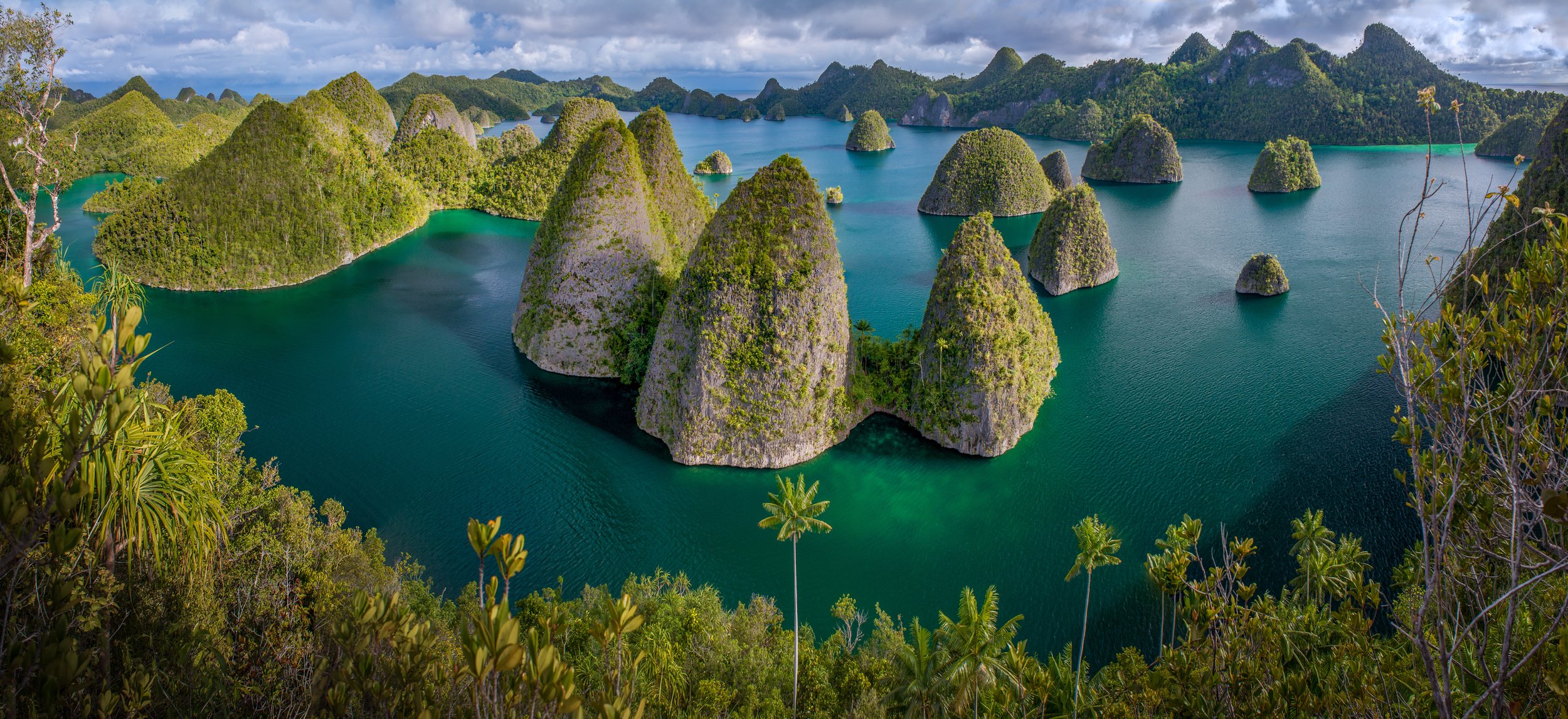
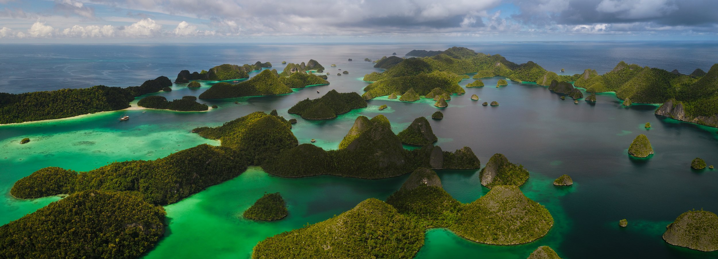
Dampier Strait Marine Protected Area
Dampier Strait MPA is the second largest of the Marine Park MPAs, covering a total area of 353,531 hectares.
Geographically, it is composed of three parts: the coastal areas of the Gam and Mansuar Islands, the coastal areas of Batanta Island, and the coastal areas of northern and north-eastern Salawati Island.
While Raja Ampat is at the heart of the Coral Triangle, the Dampier Strait is at the heart of Raja Ampat. Strong ocean currents moving from the Pacific Ocean combine with deepwater upwellings to bring an abundance of rich nutrients into the waters of the strait, providing the ideal environment for marine animals to feed and coral reefs to thrive.
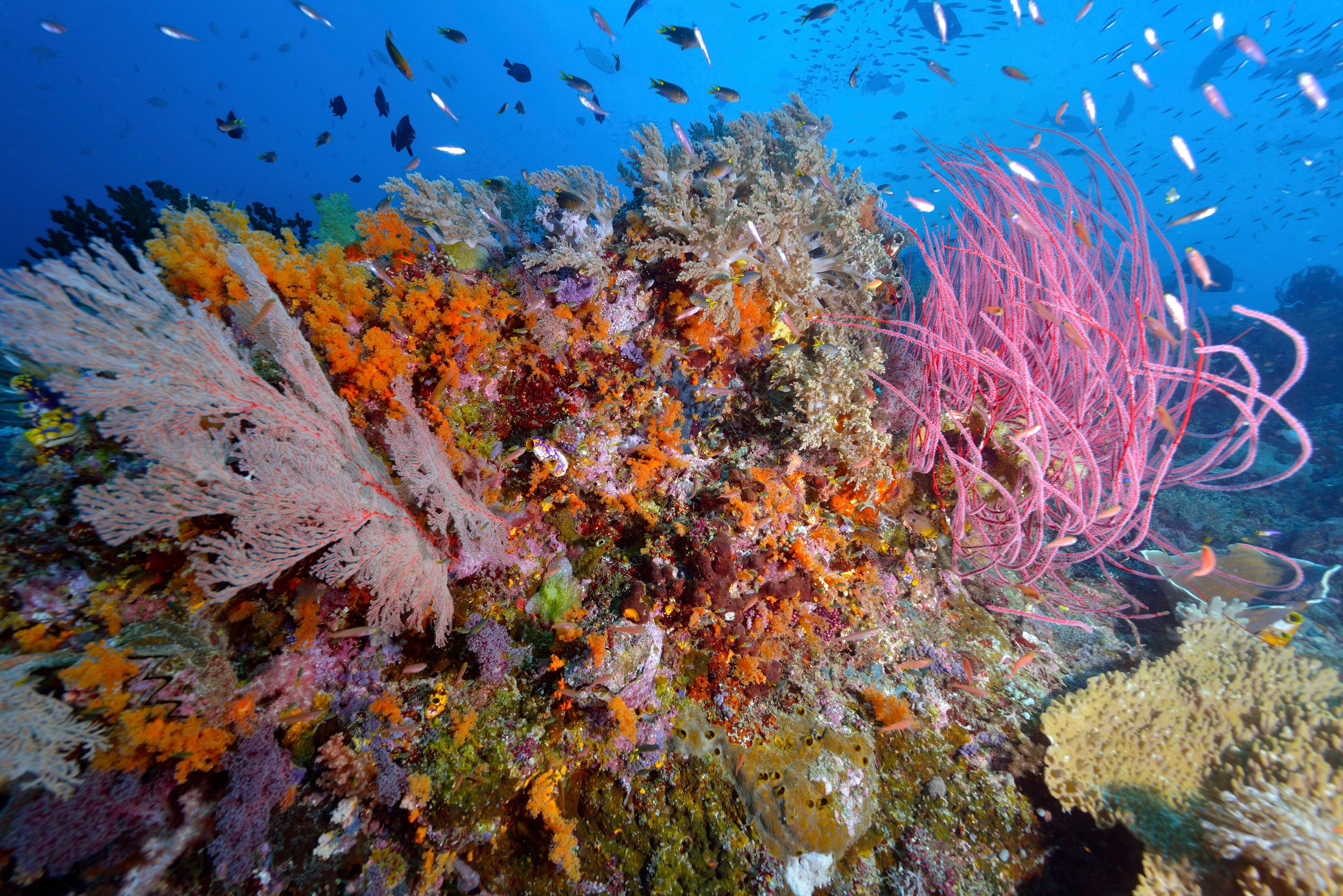
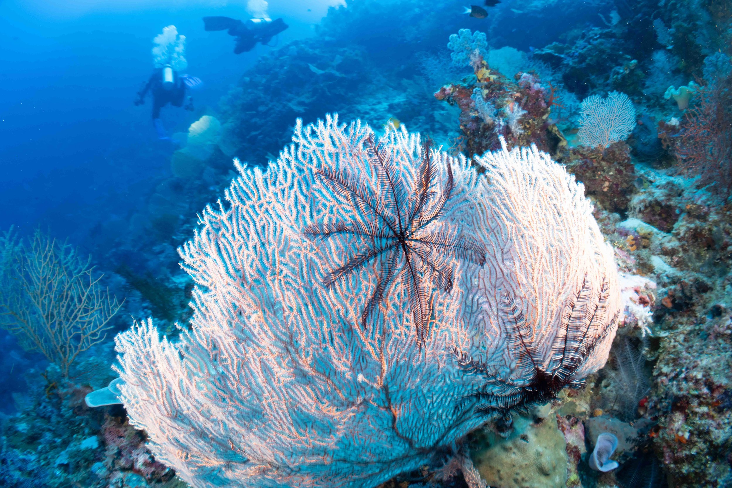
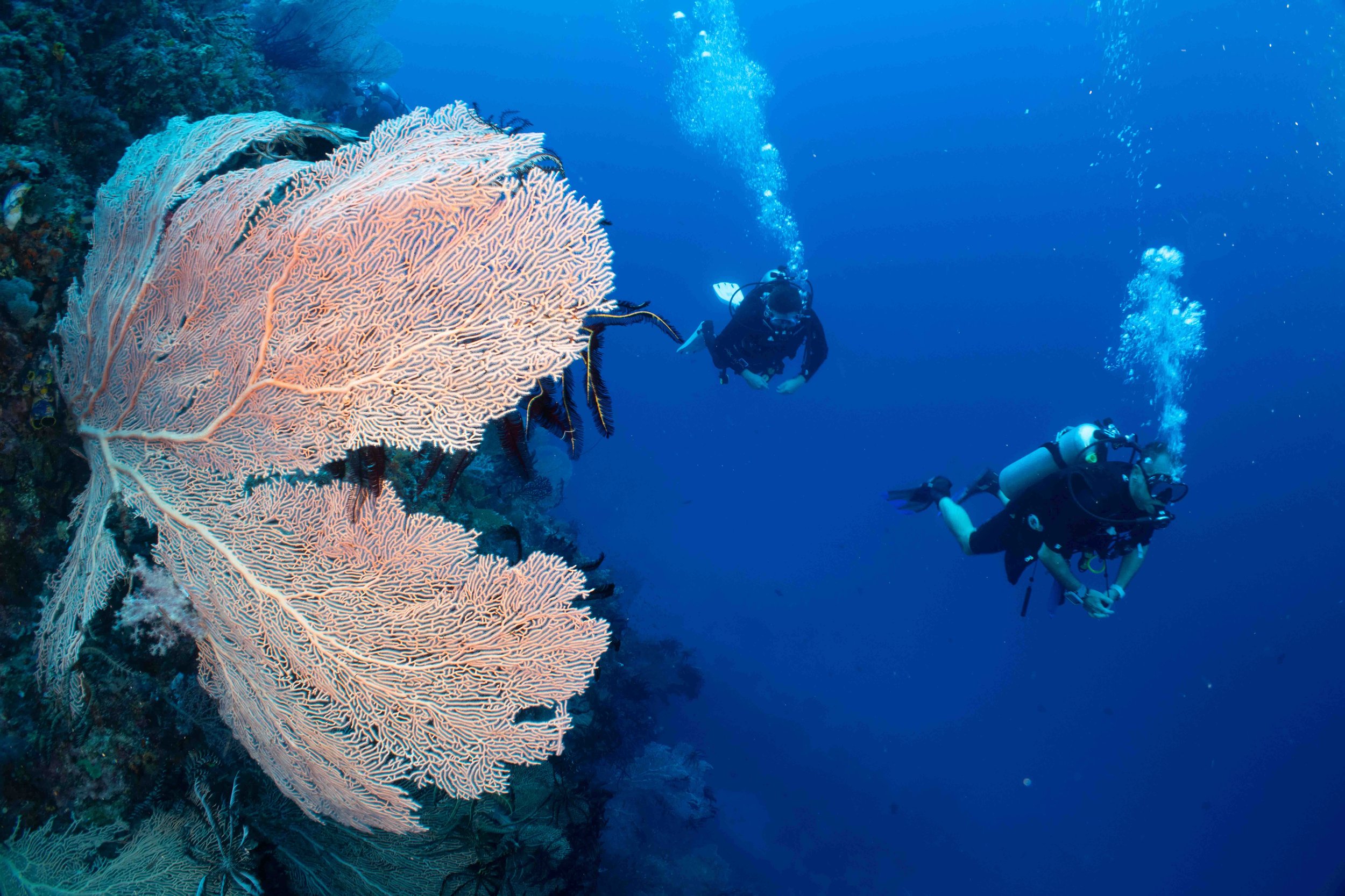
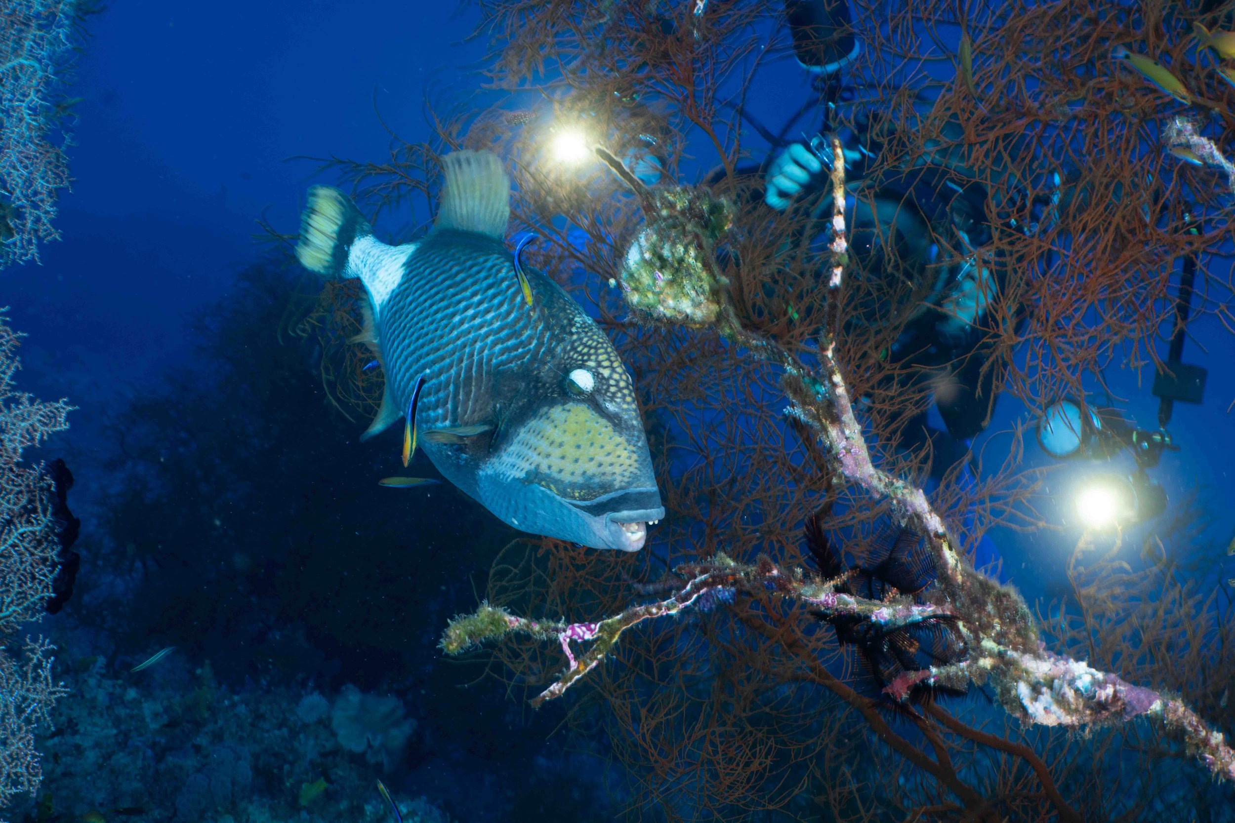
Dampier Strait MPA boasts the highest diversity in all of Raja Ampat and is known the world over for its vibrant reefs and the marine life they support. The region attracts many large pelagic fish, including sharks, tuna, snapper, grouper, barracuda, and trevally. The Dampier Strait is also a safe haven and migratory corridor for many marine mammals, such as whales, dolphins, and dugongs, and is particularly famous for its aggregations of both species of manta ray.
The reefs themselves are alive with color and movement. Soft and hard corals interconnect to form habitats for a wide variety of invertebrates and grazers, which in turn attract larger pelagic and predatory species.
With this superb underwater environment and close proximity to the district capital of Raja Ampat, the local government determined that the central area of the Dampier Strait would become the primary marine tourism area, subject to sustainable management and development principles.

Papua Raja-Ampat
Within the Dampier Strait, there are 28 coastal villages, with another 6 further inland in north-east Salawati. Villages have varying capacities to support tourism and conservation efforts, with Sawinggrai, Arborek, Sawandarek, Yenbuba, Saporkren, and Arefi being the main villages to experience cultural tourism. Visitors to these local communities in the Dampier Strait can interact with local people, watch traditional dances, view the endemic Birds of Paradise, or go kayaking. It's important to be culturally aware when visiting any community in Raja Ampat.

In more remote areas of the Dampier Strait MPA, where tourism is limited or non-existent, local communities, in collaboration with the Raja Ampat Marine Park Authority and non-profit organizations Conservation International and RARE, developed the ‘Indigenous Fisheries Area’ initiative. This initiative's development aimed to manage living natural resources sustainably, granting each village or hamlet the right to use fishing resources within their customary territories. In total, this initiative includes 10 villages on Batanta Island and 9 villages on Salawati Island.
Sustainable tourism in the Dampier Strait aims to provide local communities with definitive examples of how conservation can provide economic benefits through eco-tourism.
The GC team heads out to assess North Dampier Straight’s MPA and then film there.
Assessing North Dampier Straight for Marine Protection
Global Conservation undertook a GC Project Assessment in Marine Protection while on a diving mission in Raja Ampat last month with 24 GC Advisors, Donors, Board Members, and Marine Scientists.
Global Conservation is seeking an ideal location and GC Project Implementation Partner to deploy Global Park Defense and Community Protection for Marine Protection in Raja Ampat’s Marine Protected Areas (MPAs). After visiting 4-5 MPAs by boat, we found the most promising location around Point Yanggelo on Gam Island, which is the far entrance to the large North Dampier Straight MPA closest to the Philippines.
The GC Team visited a potential implementation partner, SEA Centre, which wants to expand into active Marine Protection after successful work creating the Manta Sandy Ranger Station, local Papuan Dive Guide School, and Megafauna Monitoring. Introduced by Goldman Prize winner Zafer Kızılkaya, president and founder of Akdeniz Koruma Dernği (the Mediterranean Conservation Society), who has been working 20 years in Raja Ampat.

The most promising location found is the 320 square miles around Point Yanggelo on Gam Island at the entrance to Dampier Straight, the closest entry from Philippines and other fishing boats from different parts of Indonesia.
Due to previous marine management and planning work over 15 years by Mark Ehrman, SVP of Conservation International, and others who worked tirelessly with government agencies, communities, science teams, and NGOs, Raja Ampat has a strong legal framework, zoning, and community agreements for world-class marine conservation. Rob Walton Foundation's exceptionally generous funding (estimated at over $100 million) made this possible.

However, Rob Walton's Foundation is not the only major contributor to the protection of Raja Ampat's glorious marine ecosystems. Andy and Marit Miners founded the Misool Foundation, which has been highly effective in safeguarding the most biodiverse reefs on Earth around Southern Misool by empowering local communities and providing a structure that allows them to reclaim their traditional tenure of reefs.
The Misool Foundation manages patrolling with five boats, three ranger stations, and a suite of conservation programs which combine marine governance, waste management, community empowerment, and species conservation.


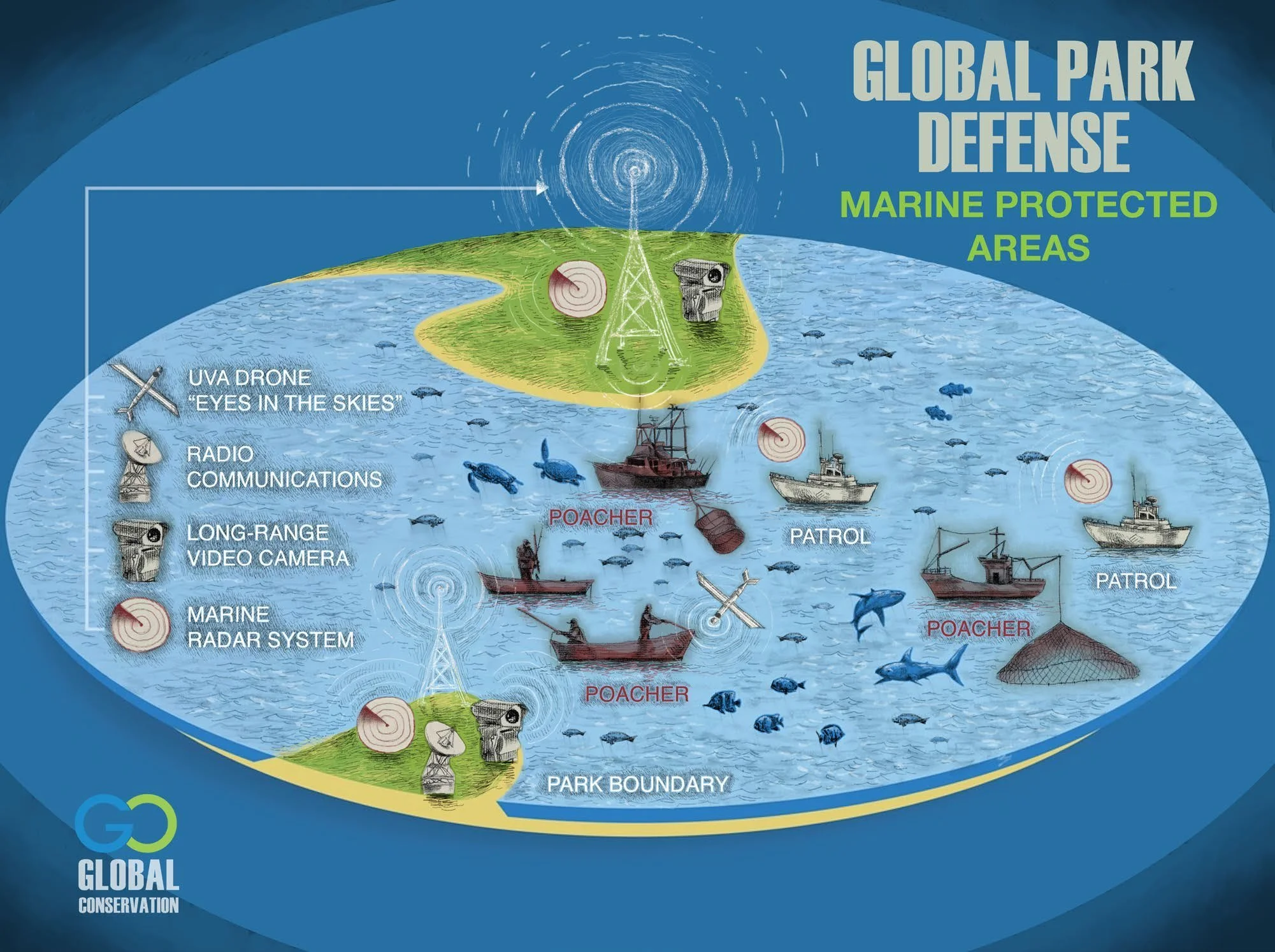
Global Conservation is seeking to replicate this successful model on other high-priority MPAs in Raja Ampat, enhancing marine surveillance with Marine Monitor radar, drones, long-range RGB and thermal cameras, and using the EarthRanger real-time marine protection system, combined with marine and fisheries monitoring.
While some say that bomb fishing is not as serious a problem as in other parts of Indonesia, illegal fishing from locals and other parts of Indonesia, like Sulawesi, has serious consequences, as some have found out. Illegal fishermen have been arrested recently, and their fishing vessels have been confiscated.

This is the result of cyanid fishing in coral habitats. Barren underwater wastelands would only now recover through protection and conservation efforts.
While bomb fishing is now much less prevalent on other Indonesian islands, cyanide fishing is still a popular method of poaching to provide for Asia's live seafood restaurants. Additionally, the aquarium trade for small fish keeps the poachers actively depleting critical marine habitat, thereby destroying underwater ecosystems globally.
Fortunately, Papua and Raja Ampat do not yet have fish freezer systems, so most legal and communal fishing is for local consumption, and large Chinese and Vietnamese fishing boats are less common.
Over the past 15 years, under the stewardship of Dr. Mark Erdmann, Vice President of the Marine Asia-Pacific Field Division, many government, community, science, and NGO leaders have combined with the exceptionally generous funding from the Rob Walton Foundation (estimated at over $100 million) for Raja Ampat Marine Conservation.
Conserving Raja Ampat involved a new vision, MPA planning, community engagement, marine science, and the deep involvement of all people—fishers, Papuans, and national and international diving and tourism operators.
What is now so healthy and abundant in fisheries and reef health was not always so evident.
Even today, the Raja Ampat Islands are being destroyed by bomb fishing, overfishing, and illegal logging. Additionally, invasive species are severely disrupting dive sites and other large marine habitats, with the main perpetrator species being the infamous lion fish.
GC provides a comprehensive plan, overview, training, and new technologies for partners who work with locals to protect their own waters.
Of course, Raja Ampat is not without its anti-poaching wins. In 2023, an illegal logging kingpin worth $150 million was apprehended on B Island and sentenced to 20 years, while nearly 20 illegal fishing boats poaching Raja Ampat were seized.
Sharks have seen a staggering decrease due to the fining industry. Shark fin soup is common in Hong Kong, Macau, and Southern China, as well as many Asian countries. We believe the best, and perhaps only, solution is for China to put bans on shark fin soup consumption. This would save the majority of the 80–100 million sharks killed just for the dried fin trade annually.

Fish bombers are caught and arrested thanks to the Raja Ampat Marine Park Authority.
Raja Ampat Marine Park Authority
The Raja Ampat Marine Park Authority, or officially named “The Regional Public Service Agency Regional Technical Implementing Unit (BLUD UPTD) in the Management of the Conservation Area (KKP) of the Raja Ampat Islands," is the Technical Unit responsible for facilitating management within Raja Ampat’s Marine Protected Areas (MPAs) as an extension of the Provincial Government’s Maritime and Fisheries Service (DKP) West Papua.
The Marine Park Authority conducts regular field patrols and surveillance. Each MPA has between 1 and 4 patrol units that have surveillance posts and operational bases in the field. Field patrols are carried out by patrol units comprised of Marine Park Authority rangers, local community members, and law enforcement officers from the Indonesian National Navy or Indonesian National Police.
Field patrols serve to:
Supervise all fishing, tourism, and other activities based on zoning regulations.
Protect the MPAs from the threat of destructive and illegal fishing activities.
Check vessel permits (for fishing and tourism).
Check that all tourists have obtained their Marine Park Entry Card.
Regulate any activity to ensure it complies with applicable Marine Park Regulations, and take firm action against any violations encountered in collaboration with law enforcement bodies.
Engage members of the public (tourism or local community members) with respect to conservation matters and environmental awareness.

A patrol ship is anchored in Raja Ampat. Photo by Shutterstock/Novem Santoso Hutauruk.
BLUD Ranger Patrol Dampier Strait Team Explaining Zonations in MPA
The Raja Ampat Marine Park Authority and Management Unit, officially named “The Regional Public Service Agency Regional Technical Implementing Unit (BLUD UPTD) in the Management of the Conservation Area (KKP) of the Raja Ampat Islands," is the Technical Unit responsible for facilitating management within Raja Ampat’s Marine Protected Areas (MPAs), as an extension of the Provincial Government’s Maritime and Fisheries Service (DKP) West Papua.
In collaboration with law enforcement officials, including the police, the Indonesian Navy, and fisheries investigators, the Marine Park Authority routinely patrols all MPAs for any illegal or suspicious activity.
The Marine Park Authority is also responsible for supervising zoning regulations, increasing public awareness about conservation, encouraging sustainable tourism activities and increasing the economic benefits derived from conservation for local communities.
Managing and protecting the 2+ million hectares of Marine Protected Area that fall under the Authority’s jurisdiction requires significant and sustainable financing over the long term, which cannot be fully supported by the funding capability of governmental bodies alone.
Therefore, one of the strategies implemented to ensure the sustainability of funding is the use of a funding system originally reserved for regional public service agencies (UPTD) combined with BLUD status. This financial structure affords UPTD BLUD the flexibility to secure revenue from environmental services tariffs along with other revenue streams and directly manage this revenue for the exclusive purpose of Marine Park Management. Additionally, UPTD BLUD has the ability to recruit non-government employees as professional staff to meet organizational needs.

The patrolling by GC’s partners and governmental organizations ensures healthy reefs to see and safe visits for tourists when they stay aboard vessels like the one pictured here.
Raja Ampat Marine Park was the first conservation area in Indonesia to implement this supportive and beneficial financial system, and through this, it is able to professionally, transparently, and sustainably manage and protect Raja Ampat Marine Park and its rich marine resources over the long term.
The mission of the Raja Ampat Marine Park Authority is to protect and manage the marine park’s natural, cultural, and historical resources while allowing ecologically sustainable use for the benefit of current and future generations.
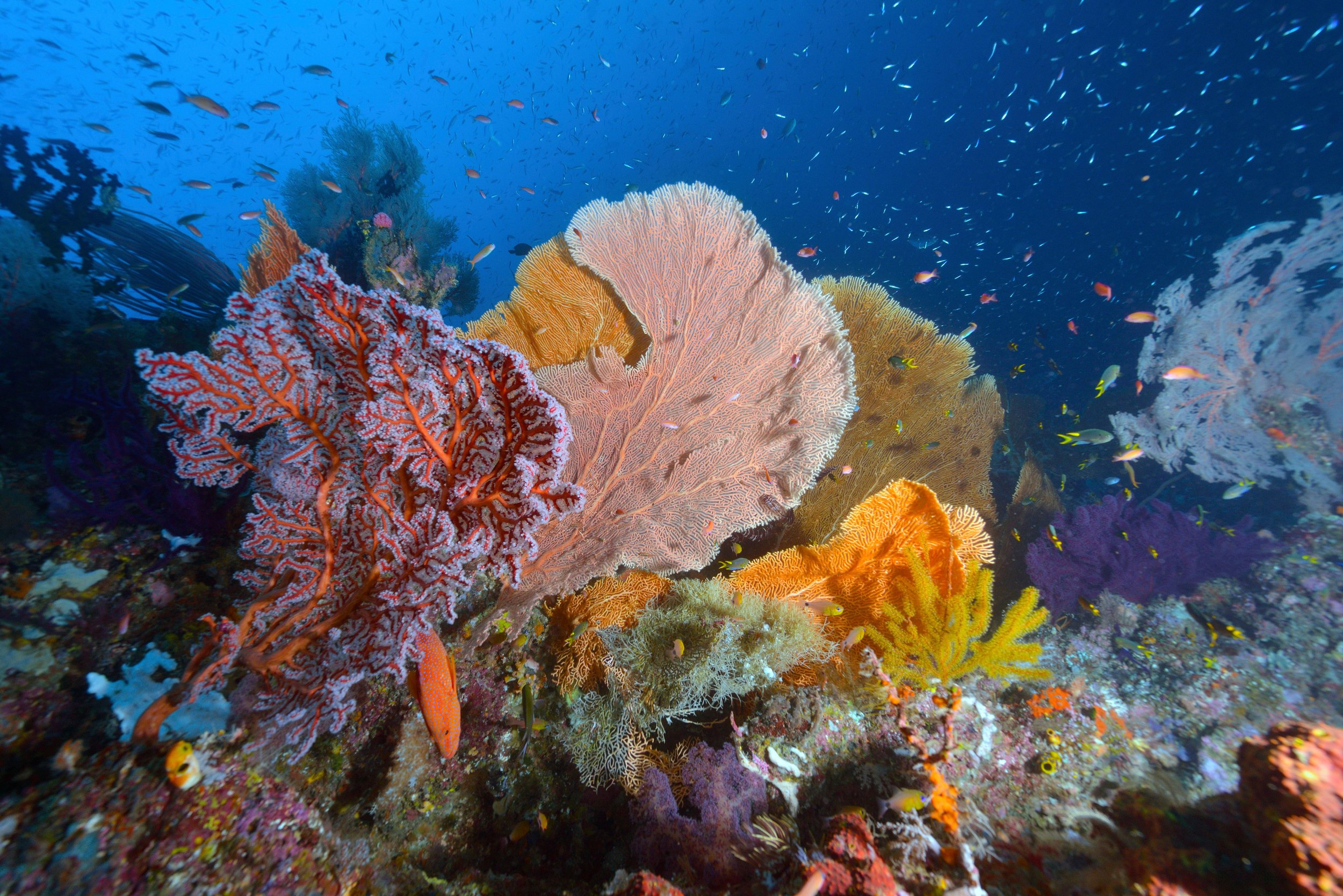
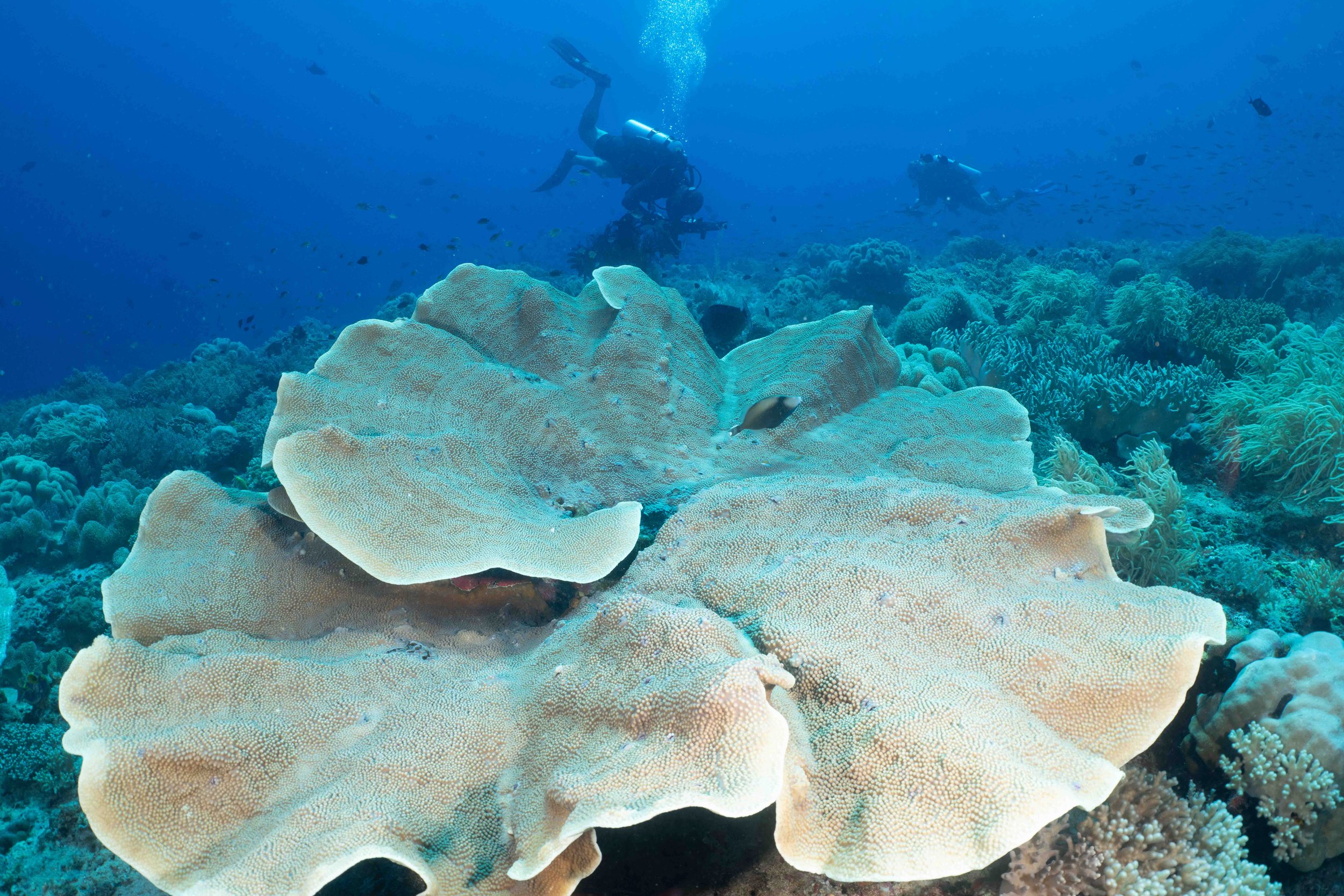
The oceanic biodiversity of Raja Ampat contains some of the most beautiful coral habitats on Earth.
Management of the Marine Protected Areas is the direct responsibility of the Marine Park Authority. In collaboration with the Indonesian National Police and Indonesian National Navy, these departments are responsible for enforcing all regulations and legislation related to the Marine Park. Click here for more information about MPA patrols.
In order to protect and conserve the globally significant biodiversity of the region and the livelihoods and industries that depend upon it, all domestic and international individuals and organizations conducting activities within Raja Ampat’s Marine Protected Areas must strictly adhere to rules and regulations.