
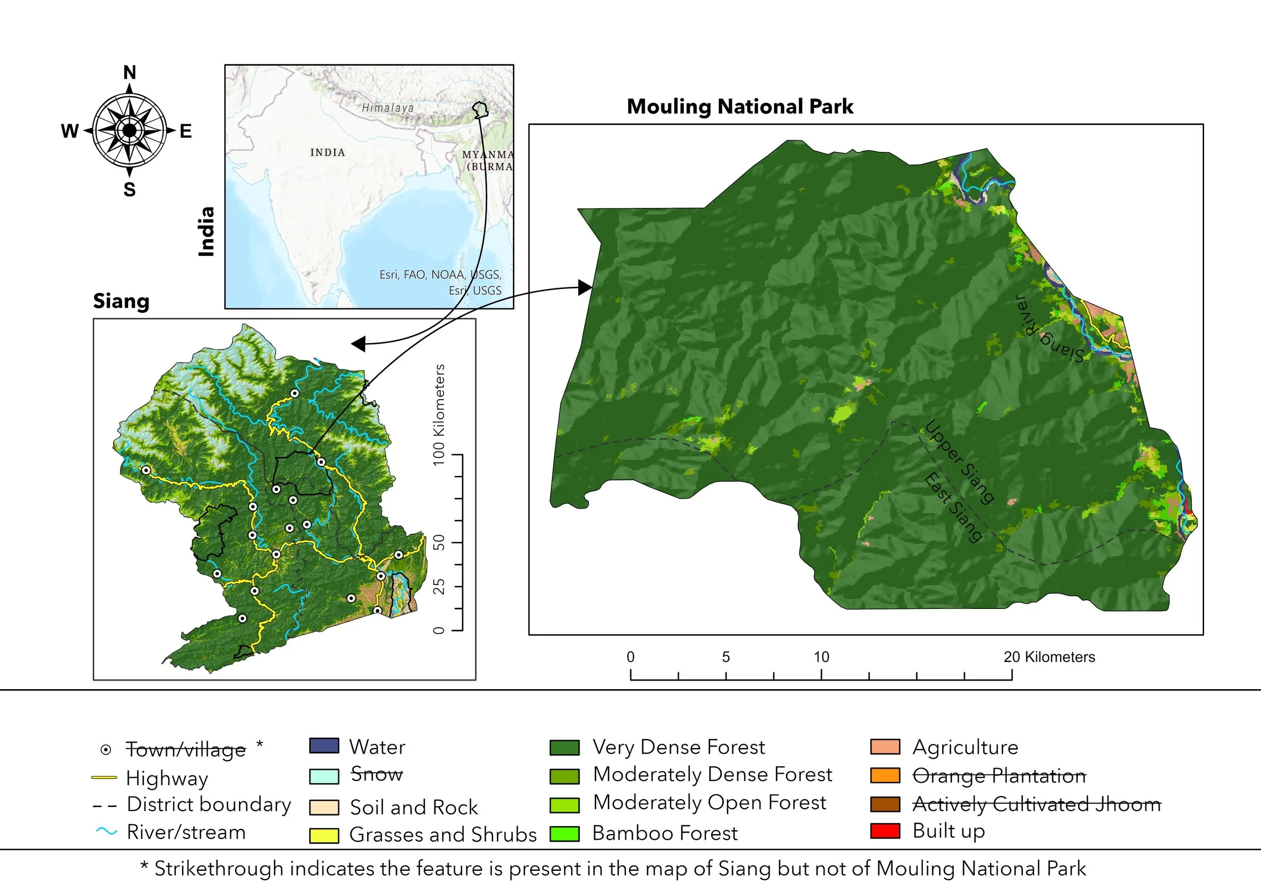
Mouling National Park, Arunachal Pradesh, India

Introduction
Mouling National Park was established in 1982 with the objective of creating a favorable habitat for plants and animals. It is located on the right bank of the river Siang and is a reserved house for diverse flora and fauna. The vegetation of the area varies according to the altitude. The upper reaches are home to temperate alpine and coniferous forests, while tropical evergreen forests cover the lower area. Ornamental plants like foxtails and orchids are abundant in this area. The park also has a diverse range of animal and bird species. Many endangered species like takins, snow leopards, golden langurs, hornbills, monal scalaters, and serows are spotted here. Experts believe that numerous species still remain unidentified and unrecorded. One can venture into this park during the winter season by taking seasonal trekking paths from Bomdo and Ramsing villages. Inside the sanctuary, there are many attractive waterfalls. Dabung Waterfall and Nirbung Waterfall are two of them. This park is thoroughly a dreamland for trekkers and animal & bird lovers.
Background: Mouling National Park
IUCN Category II (National Park)
Upper Siang, Arunachal Pradesh
Area: 483 km2 (186 sq mi) or 48,000 hectares
Established on December 30, 1986
Department of Environment and Forestry of Arunachal Pradesh
Mouling National Park is the second national park to be created in the state, after Namdapha National Park in 1972.
The park is named after the nearby Mouling Peak. Mouling is an Adi word that means red poison or red blood, which is believed to be red latex from a tree species found locally.
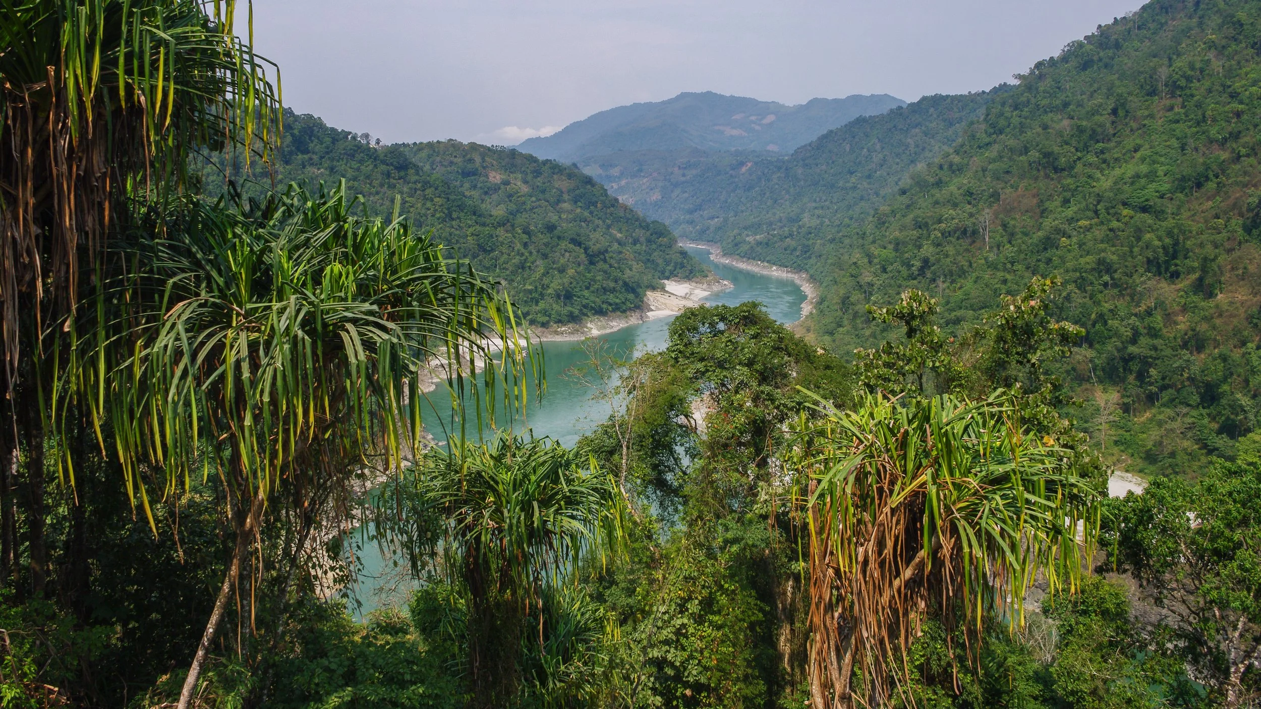
Photo ©shutterstock.com
The national park covers an area of about 483 km² forming the western part of the Dihang-Dibang Biosphere Reserve. The terrain is rugged, with an altitudinal range of 750 to 3064 m at the highest point known as Mouling Peak.
The Siyom River flows along the western fringes of the park and several small rivers such as the Siring, Krobong, Semong, and Subong drain into the Siang River near the eastern boundary of the park.
The park is under the administrative control of the Divisional Forest Office located in Jengging, and the nearest major towns are Along and Pasighat, 130 km and 185 km from the park, respectively.
An approach to the park is not possible via roads due to the remoteness of the area and the poor communication facilities in the area. The nearest airfield is located in Pasighat.

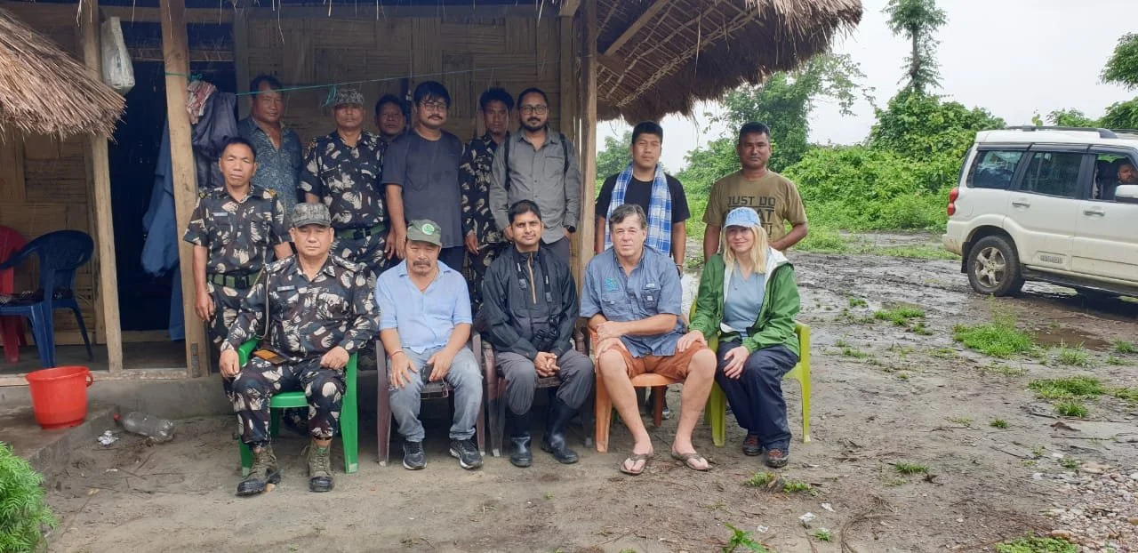
Executive Director Jeff Morgan with the Adi People.
OVERVIEW
Global Conservation is proposing an integrated program for Park and Wildlife Protection combining local Community-based conservation and exploring the development of wildlife tourism in and around Mouling National Park in Arunachal Pradesh, India.
In addition, we aim to work with park and wildlife authorities and local communities to deploy Global Park Defense for improving the effectiveness of nature and wildlife protection in Mouling National Park & Daying Ering (D’ering) Memorial Wildlife Sanctuary in the initial phase, followed by a few more additional protected areas in Siang and adjoining Dibang valley in Arunachal Pradesh.
Enveloped by a breathtaking backdrop of untouched mountains, MNP harbors an astonishing array of flora and fauna, representing an invaluable trove of biodiversity. Nevertheless, this region remains largely unexplored and unfamiliar, standing as one of the lesser-known areas within the Eastern Himalayas. Presently, the park faces grave threats from rampant illegal logging in its eastern section, where the construction of new roads has facilitated such activities. Additionally, hunting poses a significant threat to the park's integrity. Moreover, looming on the horizon is the proposed Siang Valley Hydro-electric Project, which aims to construct massive dams, ultimately leading to the complete submergence of numerous settlements and vast hectares of agricultural lands. These areas hold crucial habitats for threatened and endangered species such as the Asiatic Black Bear (Ursus thibetanus), Clouded Leopard (Neofelis nebulosa), Takin (Budorcas taxicolor), Bharal (Pseudois nayaur), and Himalayan (Himalayan Goral (Naemorhedus goral) and Indo Chinese Goral (Nemorhaedus caudatus).
PRIMARY OBJECTIVES
Park-Wide Communications
Community Protection
SMART Patrolling
Signage and Boundary Markers
Biodiversity Recovery

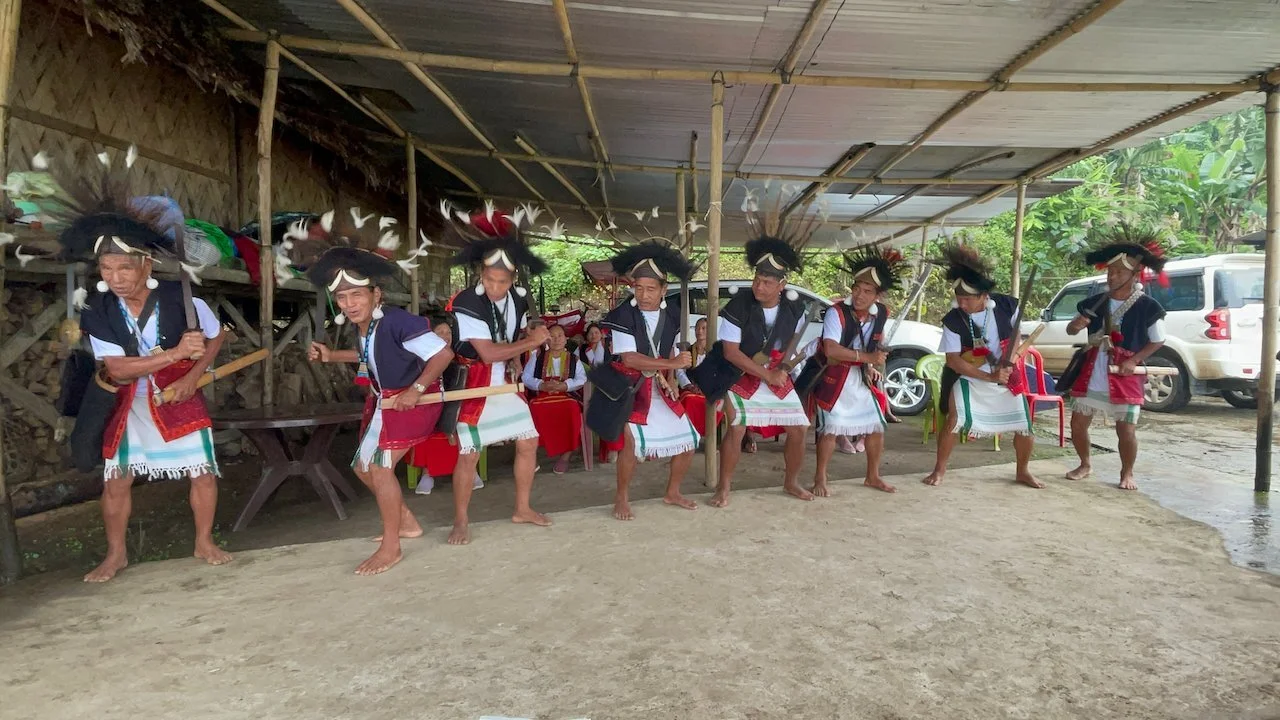
The Adi serve as the community protectors of their lands. The war dance of the Adi Tribe, called “TAPU Dance,” is usually performed by Adi warriors before going to war. Today, it's merely a ceremonial act. Photo ©shutterstock.com
GC Mission to Support the Adi Community Protection Initiative
Global Conservation, in partnership with the Ashoka Trust for Ecology and Environment (ATREE), has embarked on a new initiative focused on Global Park Defense and Community Protection in the forested areas adjacent to Mouling National Park (MNP) in the Siang Valley of Eastern Arunachal Pradesh, located in the Eastern Himalayan landscape of India.
The Himalaya Mountain Range is one of the most significant global hotspots of biodiversity and is known as the water tower of Asia, and the "third pole" in terms of the ice harbored by its glaciers. Within the Himalayas, the diverse, unexplored, and unique forests of the Eastern Himalayas have an unusually high and unique biodiversity. These forests are also our main buffers against climate change. However, the region’s natural assets are threatened by development pressures. GC supports ATREE’s work, which is focused on the Siang Valley landscape, the source of India’s largest river, the Brahmaputra, and inhabited by the Adi indigenous community.
Video courtesy of our Partner ATREE.
The region in the Siang Valley, within which MNP is situated, is characterized by forested areas largely owned by local Adi communities. These regions, inhabited by only a few Adi villages, represent some of the most remote areas in India. Notably, many of these areas lack road infrastructure and remain untouched by modern development.
This project is based on ATREE’s unique approach to conserving biocultural diversity through three critical pillars: a) science to identify what, where, and how to conserve; b) local stakeholder consultations about how to sustain and nurture local landscapes and their natural elements; and c) strengthened local capacity and stewardship to cope with change and manage natural resources. It aims to strengthen local protected area (PA) management and empower the surrounding communities to actively conserve and protect their forests from illegal hunting and logging activities. The initiative will prioritize long-term investments to enhance income opportunities and livelihoods through sustainable, non-destructive forest utilization practices.
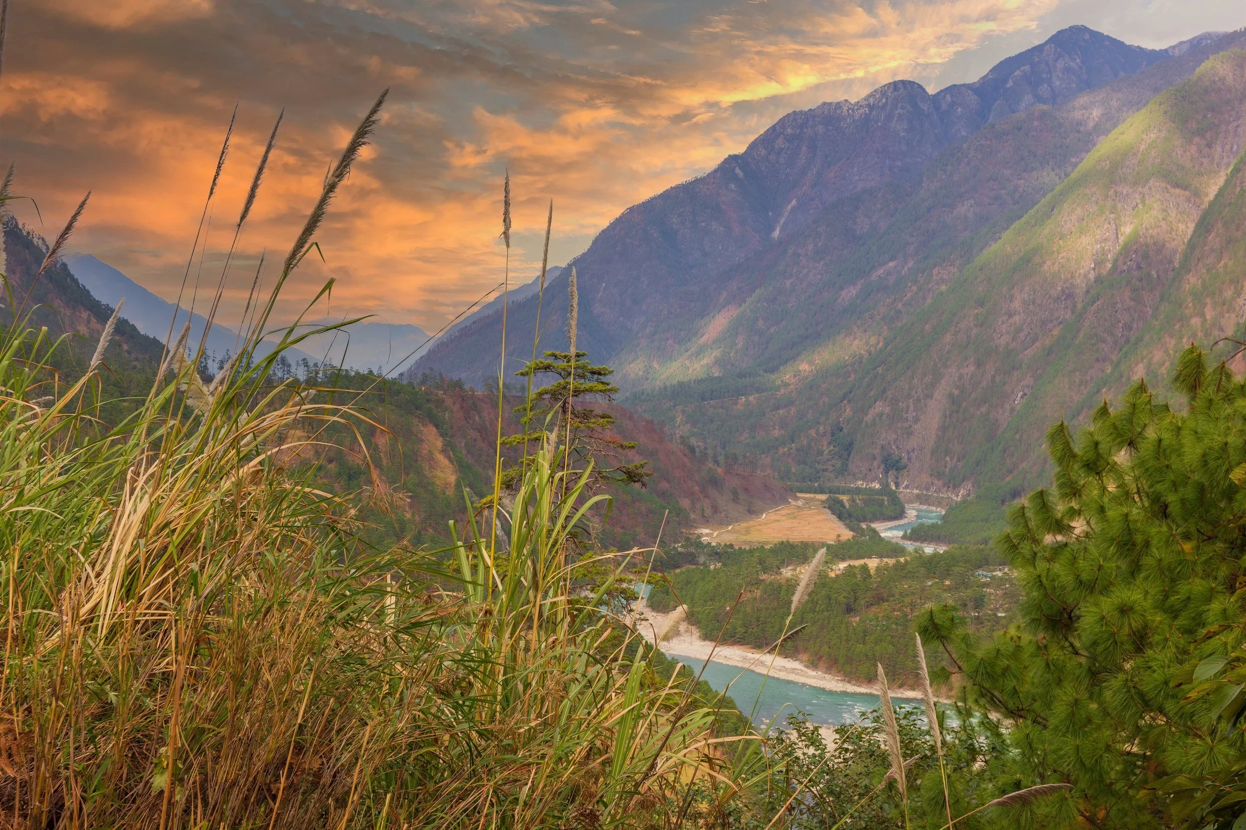
Photo @stock.adobe.com
Protecting the last intact montane forests of India in the foothills of the Himalayas, this new GC Project reinforces indigenous culture and land rights in this critical area threatened by massive new dams flooding their villages, croplands, and critical habitats for threatened and endangered species.
The Siang Valley encompasses seven administrative districts, namely East Siang, Siang, Upper Siang, Lepa Rada, Lower Siang, West Siang, and Shi Yomi. This region is blessed with fertile land and is renowned for its agricultural productivity, owing to the significant silt deposition contributed by the Siang River, which serves as the primary channel of the mighty Brahmaputra River downstream. The area boasts a remarkable biodiversity, representing the Eastern Himalayan biodiversity hotspot, the Indo-Malayan biodiversity hotspot, as well as the South China central hotspot.

Recently cleared mountainside in Arunachal Pradesh. Photo ©shutterstock.com/Niel Bowman
In such a vibrant environment, where the traditional practices of hunting and wet terrace rice cultivation are deeply ingrained, the clearance of forested land, along with poaching and hunting activities, is of great concern, especially with the escalating human population. Currently, the Siang Valley is home to approximately 250,000 people, with the majority belonging to the Adi tribal community. Other communities, such as the Galo, Tangin, Memba, and Khamba, also reside in the region.
Distressingly, over the past two decades, the Siang Valley has witnessed a staggering decline in forest cover. This deforestation primarily occurs in areas with higher human habitation, and the increasing population exacerbates the alarming rate of forest loss. In collaboration with the Ashoka Trust for Ecology and Environment (ATREE), Global Conservation is committed to safeguarding this landscape from further deforestation. This crucial mission relies on the support and collaboration of the forest department and the local Adi community institutions and leaders. Urgent action is imperative, as without immediate intervention, the Siang Valley will experience the irreversible loss of most of its forest cover within the next few decades.

The Adi People number over 200,000 up and down the Siang River Valley, with key villages involved in the project to reduce logging and deforestation, as well as hunting pressures.
India ranked second highest for the deforestation rate after losing 668,400 hectares of forest cover in the last 30 years. India also topped the chart for the biggest increase in deforestation between 1990 and 2020, with a difference of 284,400 hectares in forestry loss.
India has lost 2.4% of its forests in the past 30 years, with Arunachal Pradesh, one of the Seven Sisters states of NE India, losing 4% of its forests in the same period.
Stopping logging and deforestation will take a concerted effort between Adi Communities, National Park authorities, and the leadership of ATREE.
Global Conservation is funding an integrated program in collaboration with the Adi indigenous communities in the Gateway villages to Mouling National Park, which includes:
Sustainable Tourism and Agriculture
Community Patrolling
Reinforcing National Park Ranger Teams
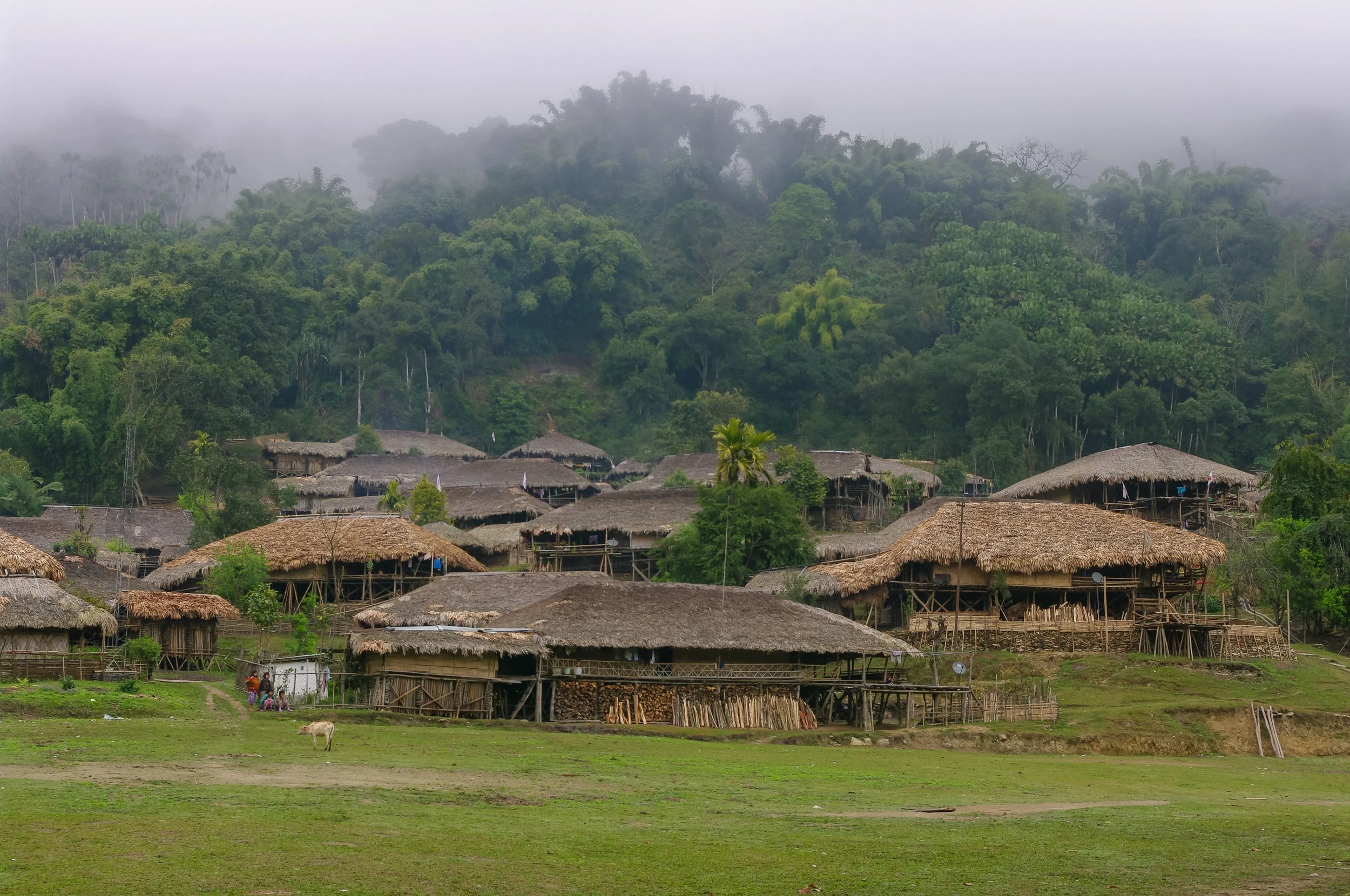
Photo ©shutterstock.com
Currently, the villages surrounding Mouling National Park are positioned at least 10 to 50 kilometers away from the park boundaries, allowing for the preservation of natural primary forests in the immediate vicinity. However, the construction of new roads into these pristine areas, coupled with the proposed 10 MW dam within the Siang Valley, poses a severe threat. These initiatives are projected to attract tens of thousands of settlers to these remote mountainous regions, potentially leading to the extinction of the Adi People in their current form. With a mere two forestry officers, two rangers, and a Park Director, along with minimal field staff, tasked with safeguarding over 40,000 hectares of challenging mountainous terrain, the protection of MNP becomes an impossible undertaking. Each year, the clearing of land by thousands of individuals for cultivating crops such as corn, oranges, and bananas results in the destruction of the surrounding forests, eroding the last vestiges of India's intact primary forests.
In pursuit of the larger objective to safeguard the world’s last remaining montane forests in the Eastern Himalayas, the newly proposed GC Project takes a firm stance on preserving the indigenous culture and land rights of the Adi communities. Deeply intertwined with the forests, environment, and biodiversity, the Adi community holds a profound connection to these natural resources. The project's primary focus lies in mitigating and addressing the aforementioned critical threats to their cultural heritage and the region's rich biodiversity. By doing so, it strives to uphold and reinforce the Adi community's long-standing traditions and sustainable livelihood practices, which have effectively conserved these forests for potentially countless generations.
While the well-known and high-profile protected areas in India, particularly those that can boast of harboring iconic species such as rhinoceros and tigers, receive substantial funding for their protection, remote protected areas in Arunachal Pradesh, such as MNP, lack comparable financial resources and staffing. MNP, for instance, currently employs a mere one ranger for every 10,000 hectares, in stark contrast to the higher-profile PAs of India, where the ratio ranges from one ranger for 7,000 to 8,000 hectares. Similarly, the allocation of approximately 3–4 forest guards per beat falls significantly short in low-profile protected areas, whereas high-profile parks often benefit from around 100 forest guards per beat.


Future Tourism
Mouling National Park has excellent potential to become a popular nature tourism destination due to its incredible geology, incredible bird diversity, and rare and elusive wildlife. The intact forests and critical yet breathtaking river ecosystems add to the enchantment of the area.
By combining all the most important core areas and developing new corridors for wildlife connectivity through community-based conservation of forests and improvement in the management and protection within the existing protected area, we expect Mouling National Park in the mountains and Daying Ering Memorial Wildlife Sanctuary within the river-islands of the Siang, further downhill, to become important destinations for hardcore wildlife enthusiasts, birders, trekkers, hikers, and nature enthusiasts.
Threats
Illegal Land Settlement
Illegal Logging
Land Clearing
Hunting for Trade and Trafficking

Forest cleared for oranges, rice paddies, and cane sugar stocks (harvested). Wild cane or Rattan (climbing palms) whose stems are in high demand and largely used to make crafts and furniture.
Each year, the clearing of land by thousands of individuals for cultivating crops such as corn, oranges, and bananas results in the destruction of the surrounding forests, eroding the last vestiges of India's intact primary forests.
The recent spurt in the construction of new roads into these pristine areas, coupled with the proposed 10 MW dam within the Siang Valley, poses a severe threat. These initiatives are projected to attract tens of thousands of settlers to these remote mountainous regions and can have serious negative impacts on the local culture, forests, and biodiversity. With a mere three rangers and a Park Director, locally known as the Park Divisional Forest Officer (DFO), along with a handful of field staff, safeguarding over 40,000 hectares of forests spread across remote and rugged mountainous terrain can be highly challenging.