Marine Protection for Baja Sur, Mexico 2024-25 Impact Report
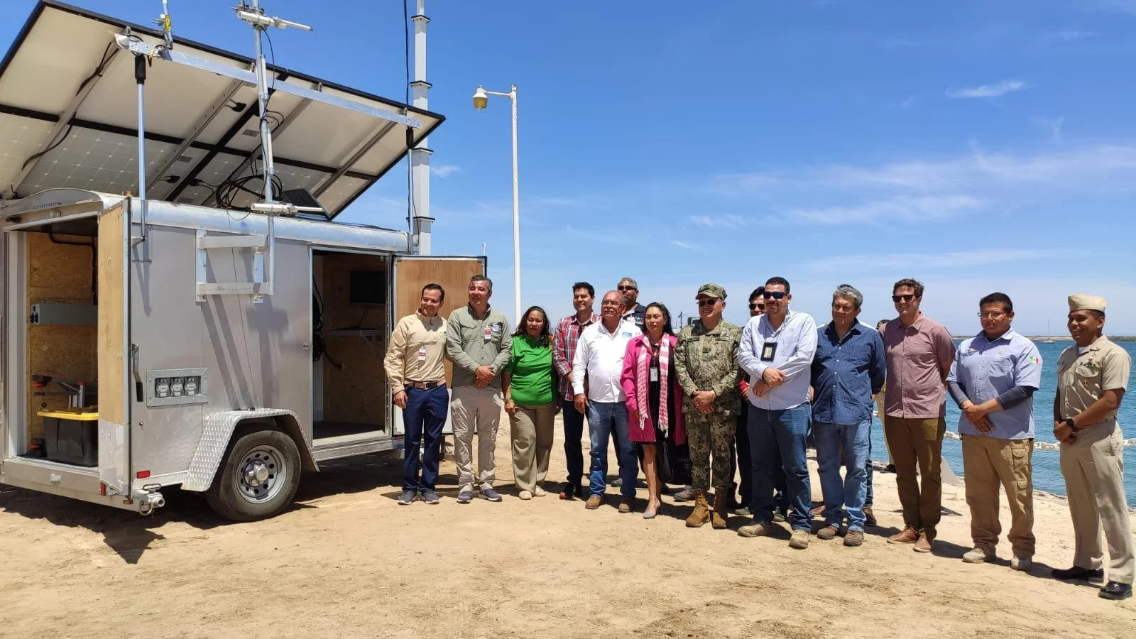
The first-ever Mobile Marine Monitor (M3) was deployed in Mexico. The M3 provides accurate information regarding vessel loitering and sailing navigation between Loreto and the marine corridor and triggered > 2900 alarms in 2024.
Global Conservation’s primary objective on land and sea is to protect the endangered marine ecosystems of the Baja Sur marine corridor from Loreto to East Cape (Boca del Álamo) by alleviating the pressures of illegal fishing, unregulated tourism, overfishing, and increasing marine traffic.
Our strategy focuses on providing resources and fostering partnerships. We work with national parks, fishery authorities, communities, and NGOs to enhance their capacity and commitment to combating illegal, unregulated, and unsustainable (IUU) fishing. Our main tactic is promoting our Global Park Defense methodology, which has shown to be an effective, flexible, and robust approach to marine protection. Additionally, we assist in the recovery of commercial fisheries, protecting critical habitats (coral and rocky reefs, kelp, sandy bottoms, and mangroves), as well as iconic marine species such as sharks, marine mammals, turtles, and commercial species. GPD relies on a blend of expertise, collaborative patrolling, and technology, including a network of 24/7 real-time marine radars equipped with specialized software for remote surveying of large areas.
In 2025, through the regular operation of marine monitors (M2), instigating collaborative patrols and training and education programs, empowering local leaders in community fisheries, and partnering with agency officials, we took major steps toward the embrace of Global Park Defense throughout the Baja Sur Marine Corridor and Center Pacific.
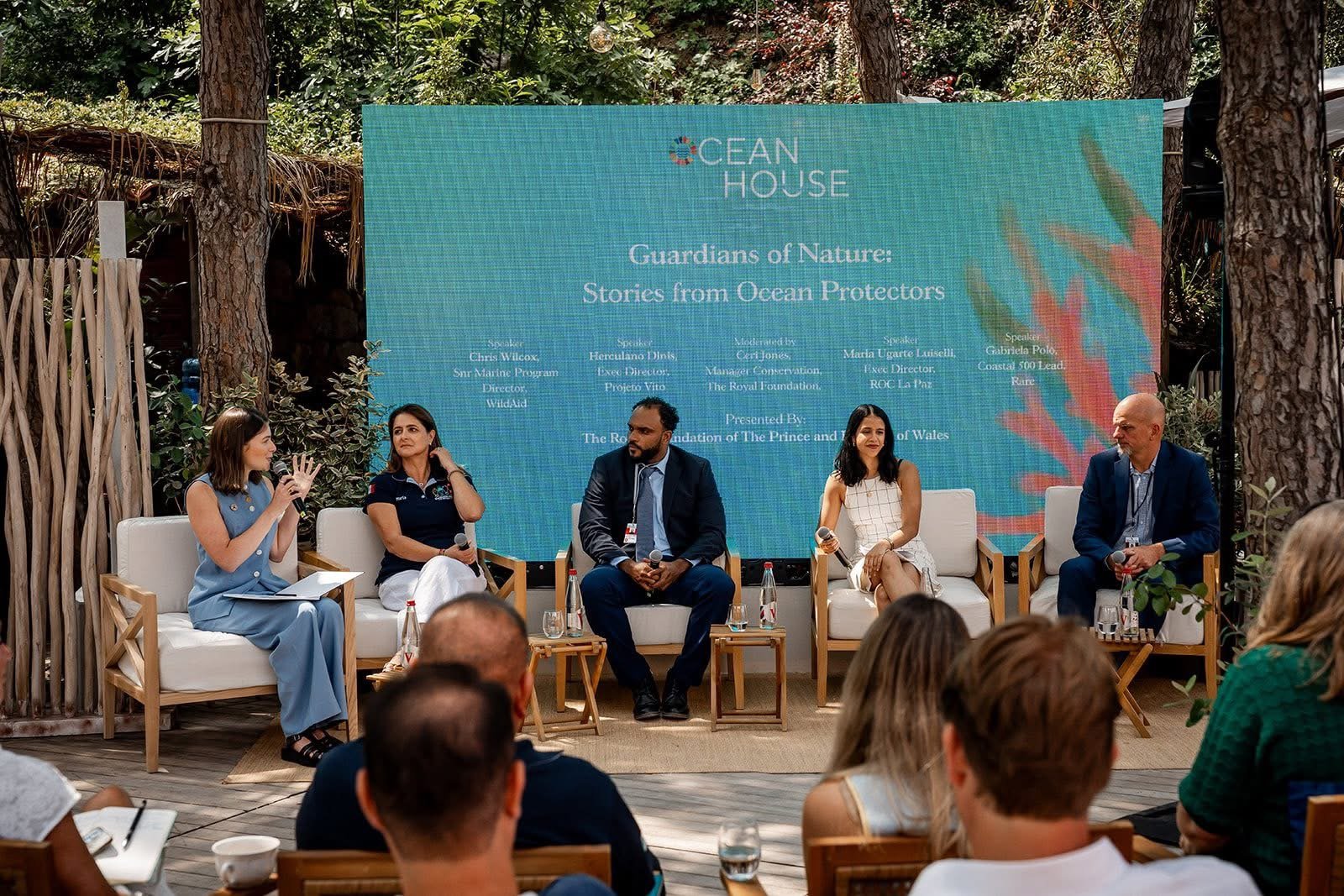
This report presents the outcomes of a multi-year project aimed at strengthening marine conservation across Baja California Sur. Through coordinated enforcement patrols, community engagement, and direct interventions, the program has contributed to measurable improvements in habitat protection and local stewardship. Efforts spanned key regions, including La Paz Bay, the marine corridor, Loreto National Park, Espiritu Santo National Park, and the East Cape, engaging partners from government agencies, academic institutions, fishing cooperatives, and local communities. The results demonstrate meaningful support and the groundwork for long-term ocean resilience.
Baja Sur Marine Corridor from Loreto to East Cape.
Background
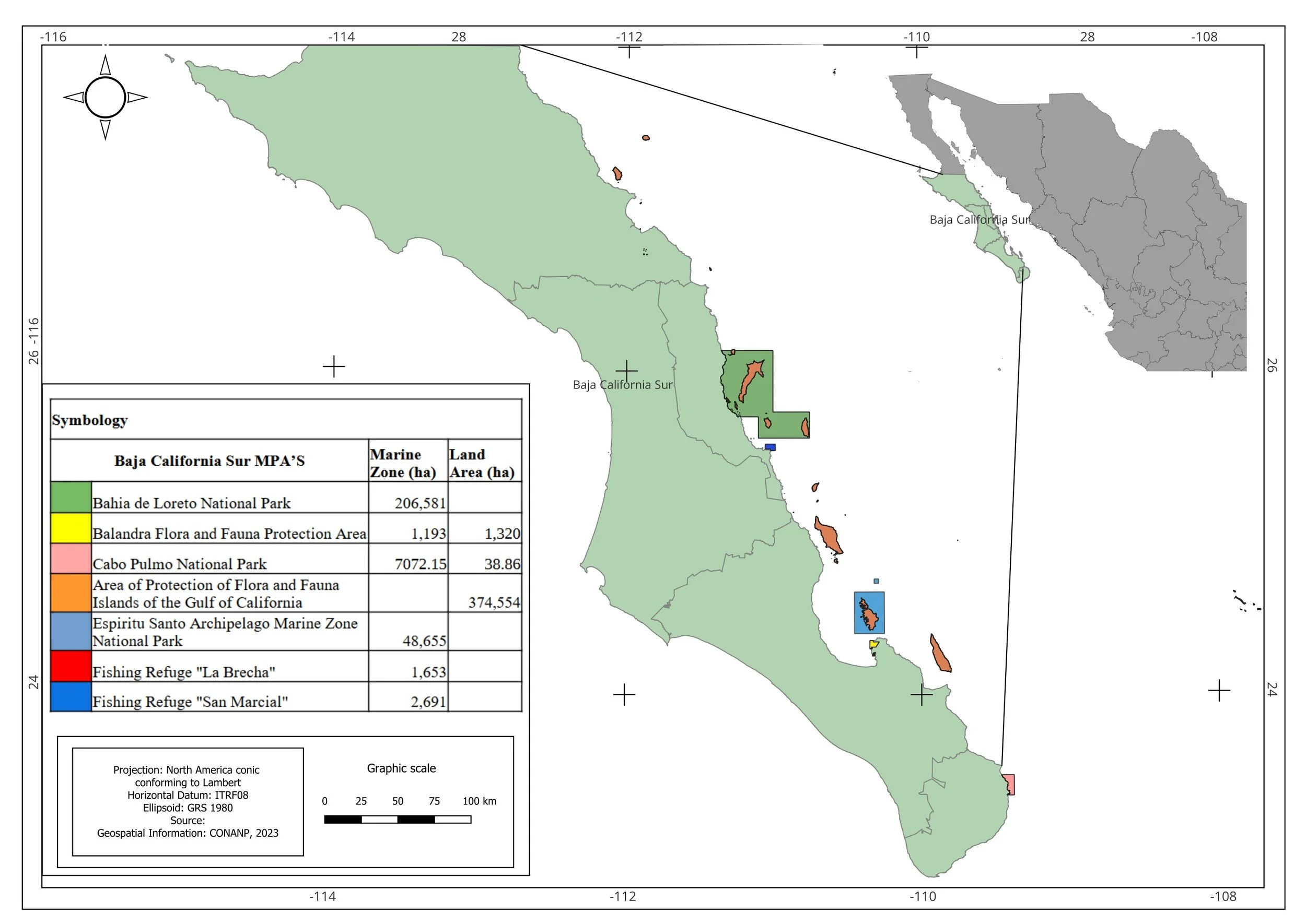
The Baja California Sur marine corridor covers an area of approximately 27,200 square kilometers, yet only about 7.8% of this region is currently designated as a no-take zone. In recent years, it has become highly threatened by an increase in marine traffic, with many community fisheries on the brink of collapse, diving operations proving unprofitable and key species like hammerhead sharks disappearing from this vital marine ecosystem. After years of exploitation by mainland industrial fishing fleets, Baja California Sur requires recovery and protection from dark industrial fishing, which has significantly depleted this underwater paradise, leaving behind ghost nets and longlines and killing species as a result of bypass fisheries throughout the UNESCO World Heritage site—one of the world’s most critical marine ecosystems. Illegal fishing, shark finning, industrial fishing controlled by cartels and intensive sports fishing all pose threats to Baja California's Sur East Cape and risk the extinction of entire species.
Neither the three national parks nor CONAPESCA, the National Aquaculture and Fishing Commission, with which we collaborate daily, have sufficient resources—boats, wardens, law enforcement, and fisher community liaisons—to effectively counter increasing pressures and the collapse of fisheries. Global Conservation (GC) works to improve compliance and marine protection at a seascape scale in the corridor, targeting:
San Basilio Bay
Loreto Bay National Park
Agua Verde and other community fishing reserves
Espíritu Santo National Park
East Cape - Boca del Álamo
Islas Marías Biosphere Reserve
Supporting central-america national parks
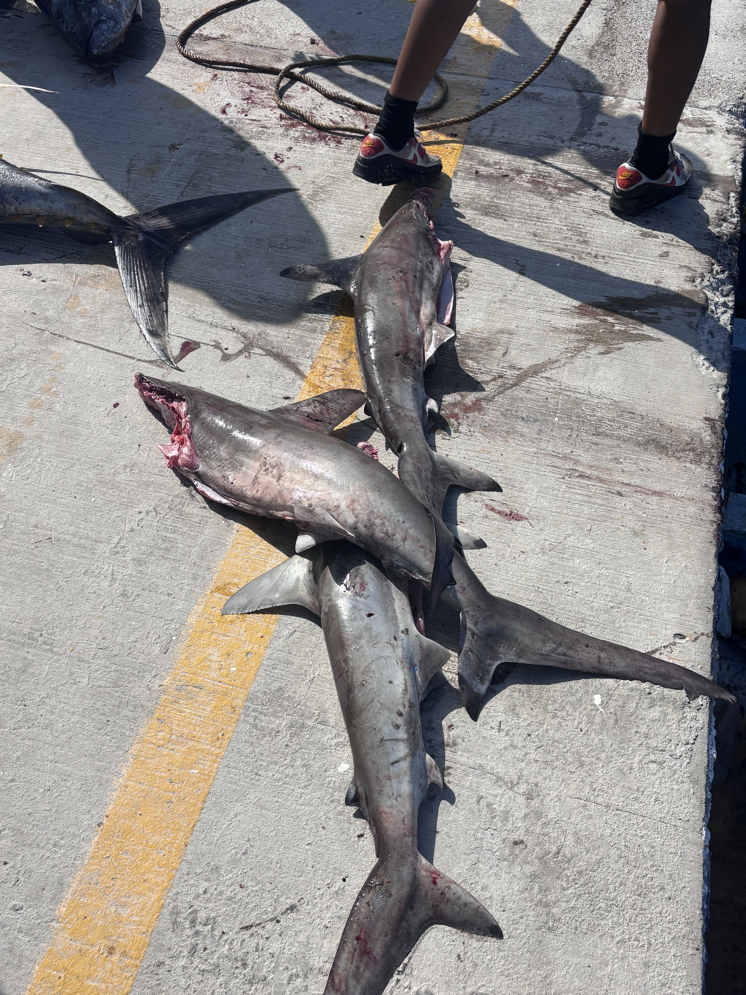
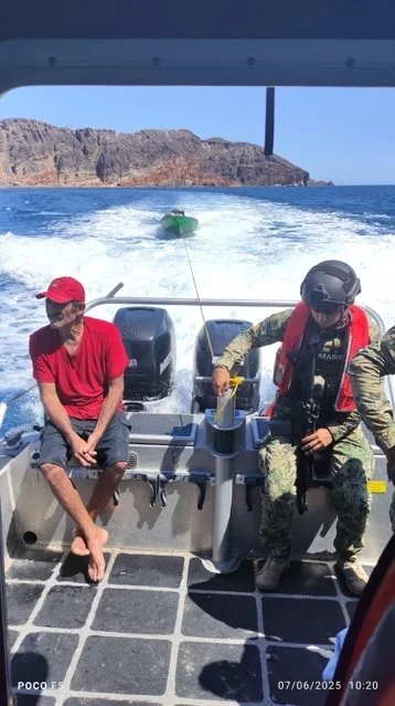
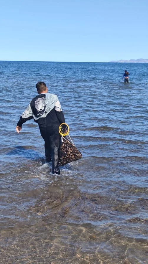
Poachers are caught and their catches confiscated.
Along 2023, 2024 and 2025 Global Conservation has been working to protect endangered marine ecosystems in Baja California Sur, Mexico, advancing five critical strategies for marine protection in Baja California Sur:
Real-time Surveillance—now four marine radars with 24/7 monitoring and monitoring control rooms;
Increase area under protection—two new marine radars in progress to deploy at Islote El Pardito and Espiritu Santo National Park, including +30,000 with enhanced protection.
Increasing Rapid Response—patrols have nearly tripled in 3 years;
Joint CONAPESCA Operations—unprecedented integrated patrolling with the fisheries ministry;
Co-fund and raise funds with Conservation Partners.
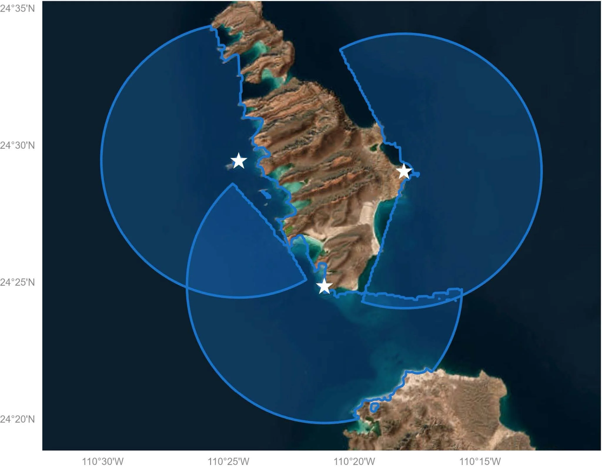
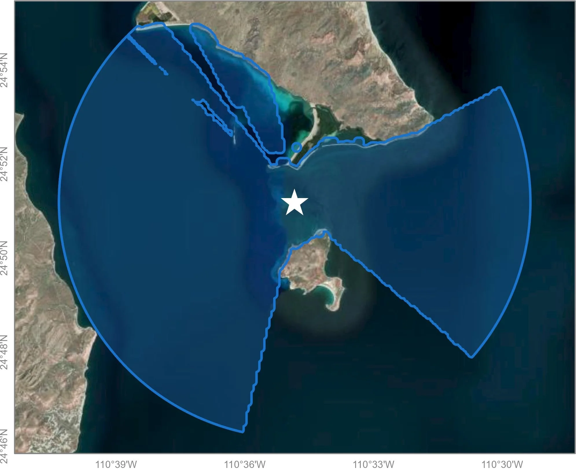
Figure 1-2 shows the viewsheds of the Marine Monitor in Espiritu Santo National Park (left) and Islote el Pardito (right), with deployment currently in progress.
Since 2020, GC began deploying multiple Global Park Defense systems for marine protection from Loreto Bay National Park in the north to San Jose Island and Espiritu Santo National Marine Park off La Paz, as well as community fishing reserves from Agua Verde in the north to Boca Del Alamo in the south. Global Park Defense is working on the ground, combining technology, knowledge, engaging authorities, and expertise. It includes a network of 24/7 real-time marine radars and specialized software for remotely surveying large areas, which is integrated with Skylight, AIS Antennas and Earthranger.
After three years, Global Park Defense has been adopted by Mexican authorities and enforcement agents across the marine corridor, including Loreto National Park, Islas del Golfo de California at Baja California Sur, Espiritu Santo National Park, Balandra, and the La Paz Bay area. We have built collaborative relationships with key government partners, park authorities, communities, fishing reserve leaders, NGOs, and funding partners such as PRONATURA, ROC, and Alumbra Innovations Foundation. This impact report covers 2025 progress and outlines the challenges ahead for our marine protection work in Baja California Sur, Mexico.

CONAPESCA—Loreto National Park—Espíritu Santo National Park Patrols 2025 cover all together more than 20,000 km.
Our Global Park Defense for Marine Protection—Baja Sur, Mexico
During the 2025 annual cycle, Global Conservation has focused on ensuring permanent enforcement and compliance actions while leveraging financial resources, training, technological integration, and community engagement. Additionally, we are scaling up our Global Park Defense marine program to expand coverage under surveillance along the marine corridor and Espiritu Santo National Park, including MPAs such as Balandra, Whale Shark Sanctuary, and Cerralvo Island.
We opened new collaborations with authorities such as SEMARNAT BCS to support and link with our partners, EarthRanger, to develop an e-logbook to monitor a new activity in the region: orca watching and swimming.


These efforts aim to enhance the capacity of local and regional authorities within the region to counter the identified threats (driven by both human and natural pressures) in this area, including:
Illegal, unregulated, undocumented (IUU) fishing
Overfishing,
Unregulated tourism,
Increase coverage under surveillance and no-take zones,
Improve enforcement and inspection patrols within the National Parks, buffer zones, and along the fishing refuge network.
Global Conservation is one of the few organizations focused on supporting National Marine Parks, and we are working to strengthen marine conservation in Mexico. We have built our strategy around five main building blocks:
Innovation and technology for marine life preservation.
Enforcement & Compliance
Engagement—Capacity building
Adoption of hardware & software solutions
Financial resource matching and alliances.
Thanks to the invaluable support of the Mary Gard Jameson Foundation and other founders, Global Conservation has been capable of achieving the following during 2025:
1) Maintained, operated, and expanded a 24/7 network of Marine Monitors along 200 km, from San Basilio Bay to La Paz Bay; this includes a new Marine Monitor in Islote El Pardito (near San José Island). Additionally, we were able to match a grant with the Alumbra Foundation to expand our GPD marine across Islas del Golfo fishing refuges and Espiritu Santo National Park.
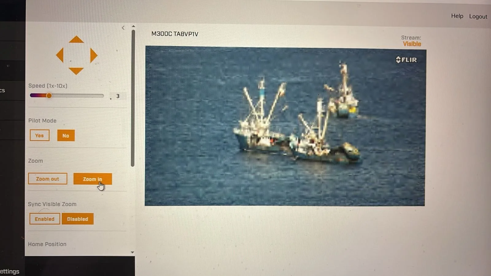
The enhanced capacity to remotely supervise and monitor large areas of sea is a key element that has been developed over the last three years in collaboration with partners through the effective adoption of the Global Park Defense strategy and its components by the MPA managers and fishing reserves with which we are working. Nowhere in Mexico, or even in Latin America, exists such a network of Marine Monitors that enables real-time oversight of hundreds of thousands of hectares, compensating for the lack of resources for conventional patrols while generating real-time information and data, producing intelligence for better operational planning, and detecting industrial vessels from other states that conduct fishing operations, some of them in prohibited zones.
This technology has attracted the attention of CONAPESCA headquarters and SEMAR, which have requested our support in gaining access to it and the local information it generates with the aim of improving the tracking of unidentified industrial vessels (AIS and VMS turned off) at specific locations. Such access has been granted to both authorities, and they have already used it.
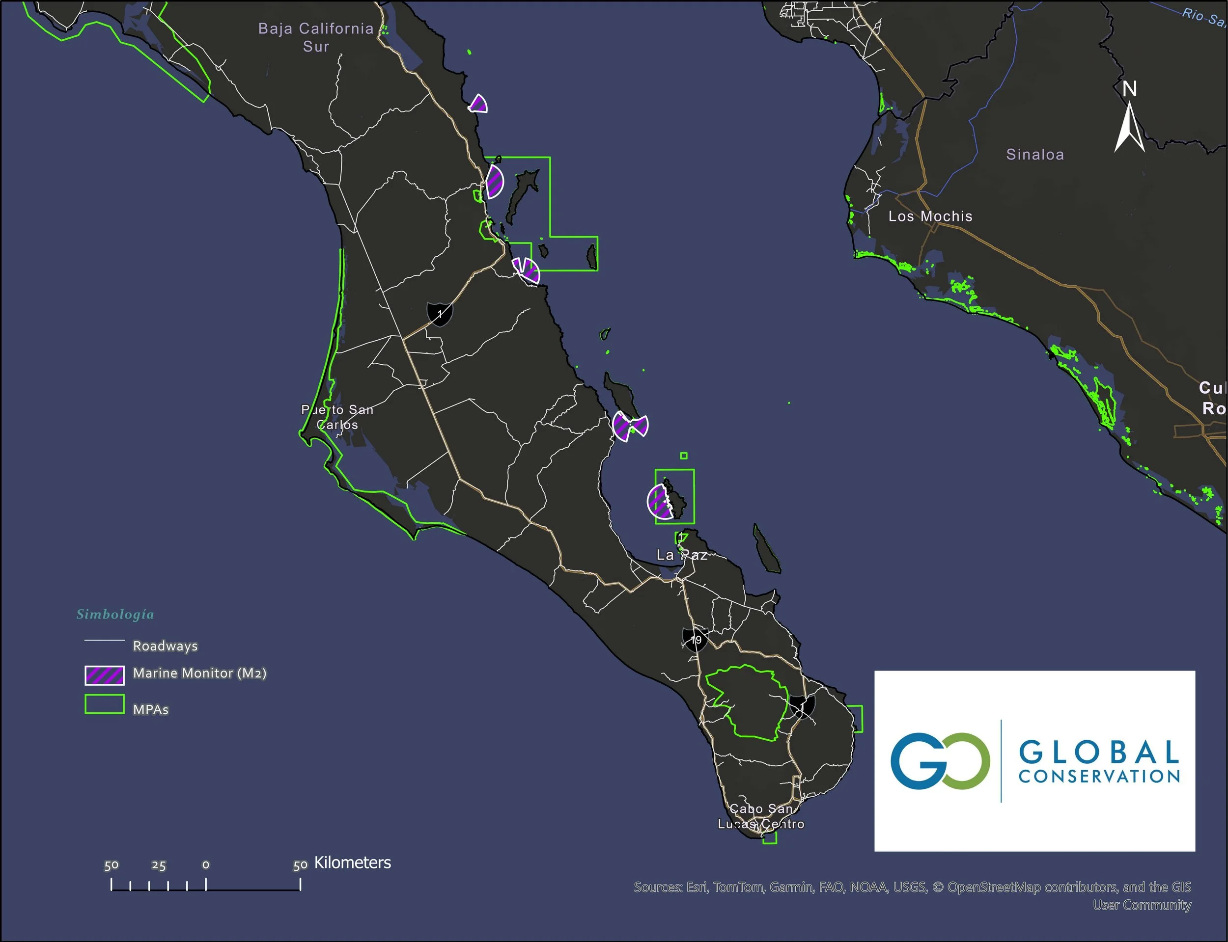
In purple, Marine monitors the network running along the east coast of Baja California Sur, México.
2) Multiplied and ensured marine and terrestrial surveillance across Loreto Bay and Buffer Zones to detect illegal fishing activities with more than 17,000 km patrolled by rangers and CONAPESCA officials, mostly in distant no-take zones near Carmen, Montserrat, and Santa Catalina Islands, as well as the San Basilio area and Agua Verde Fishing Refuge.
By covering a lodge for CONAPESCA officials, we are ensuring 100% attention to Loreto National Park and buffer zones, including fishing refugee networks to detect, prevent, and deter illegal fishing activities within the boundaries of Loreto National Park, Nopoló and Loreto II National Parks (coastal area), buffer zones, and fishing refugees.
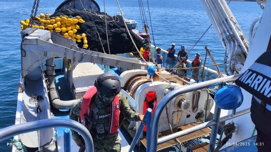
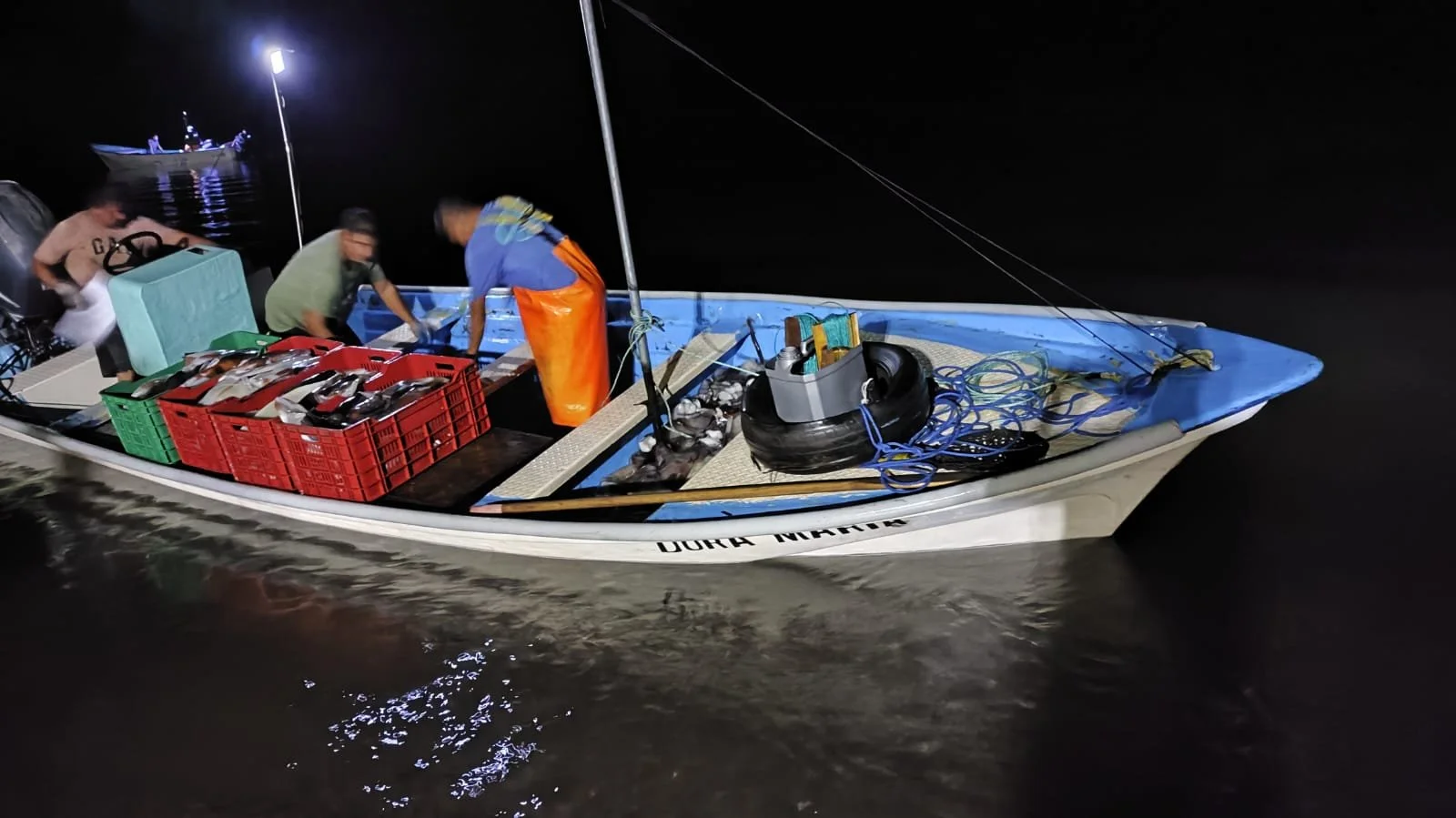
Inspection actions at Industrial vessels by CONAPESCA and SEMAR - Poacher intercepted by CONAPESCA official in Loreto NP.
On the other hand, in the case of Loreto Bay National Park, the number of alerts for entry into no-fishing zones remains low, which indicates that both the fishing population and the response capacity are discouraging illegal fishing within no-take zones.
The data from the systems indicate that there has been a decrease in the number of alerts from vessels entering no-fishing zones, except in the Agua Verde refuge, where there is constant traffic in the refuge area, not necessarily fishing. However, in San Basilio, it was evident that illegal fishing within the San Basilio Bay area was discouraged.
In addition to our Marine Monitors network in Baja California Sur, the Global Conservation Mexico and PNO team, with support from the Islas Marías Biosphere Reserve Directorate, successfully reinstalled the first M2 on a Mexican island in the northern part of Isla María Madre, which contributes to the real-time remote monitoring of over 90,000 marine hectares and the establishment of a control and monitoring center in Puerto Balleto, within the CONANP facilities. This achievement resulted in more than 65 illegal fishing boats being detained within the marine reserve in only three months. We are looking to raise complementary resources to expand the area under surveillance in the southern part of the archipelago Islas Marías.
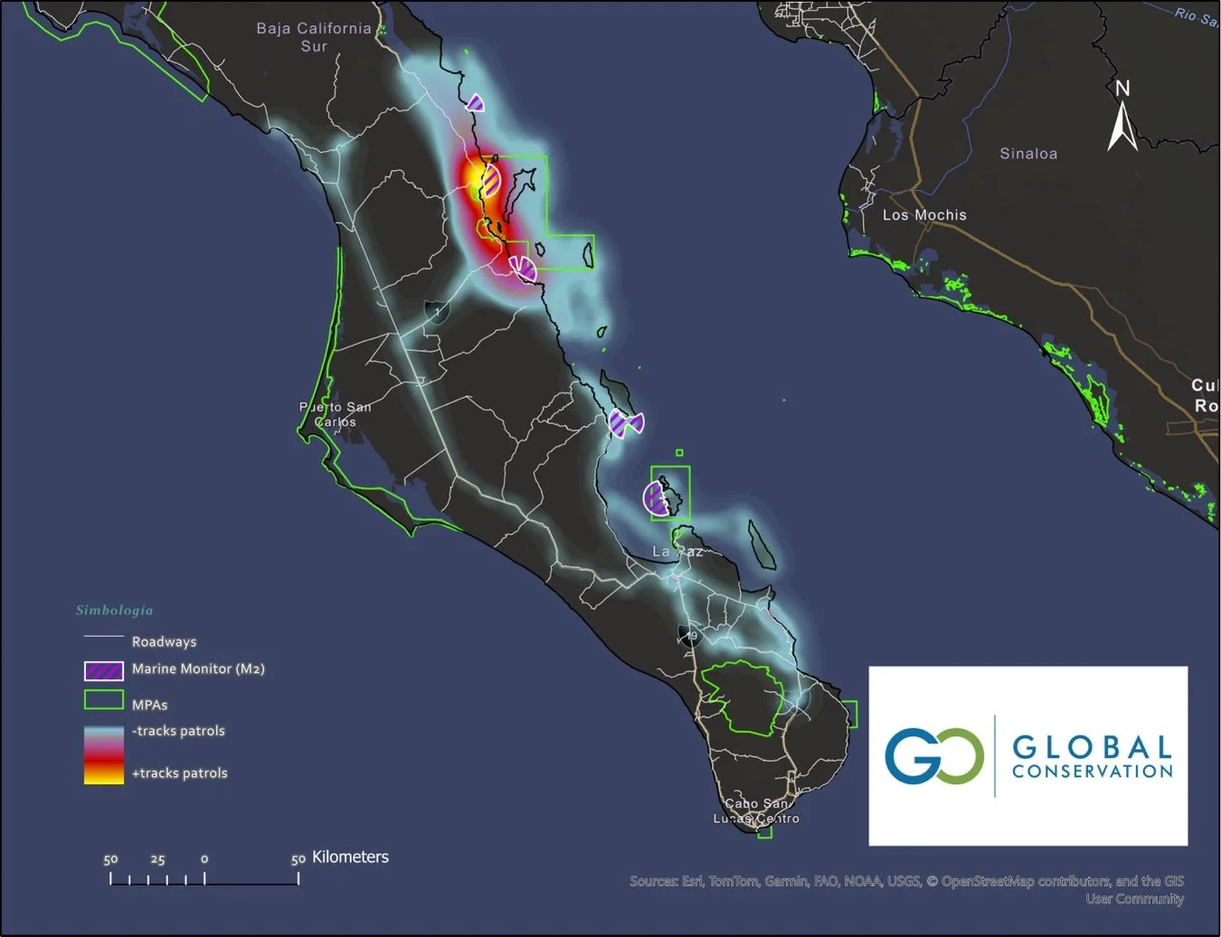
Heatmap with total patrols carried out by CONAPESCA-CONANP-GC along the east coast of Baja Sur, covering more than 300,000 hectares, including 4 MPAs and four fishing refuges.
The map above shows an integral effort to attend to and protect the east coast of Baja California Sur. This effort has been possible with the engagement of the enforcement agent, MPA's managers, Global conservation and his partners. this map represents how collaboration and commitment look when technology and on-ground work are aligned to a single mission: marine protection. We are making real protection not only of current areas but also to protect critical habitats beyond MPAs, prevent IUU activity in those zones, and spread important resources to improve protection and surveillance capacities.
Without our support, communities along the marine corridor, even cities such as La Paz and Loreto, would suffer even more from the adverse effects of illegal fishing and overfishing, negatively affecting economic activities and livelihoods.
The 2025 patrols covered at least 250,000 hectares, crossing National Parks, fishing refuges, areas with no conservation schemes, critical habitats, and new zones such as La Ventana (in front of Isla Cerralvo) and islands such as Espiritu Santo Marine National Park and Islote El Pardito, which is part of the fishing refuge network.
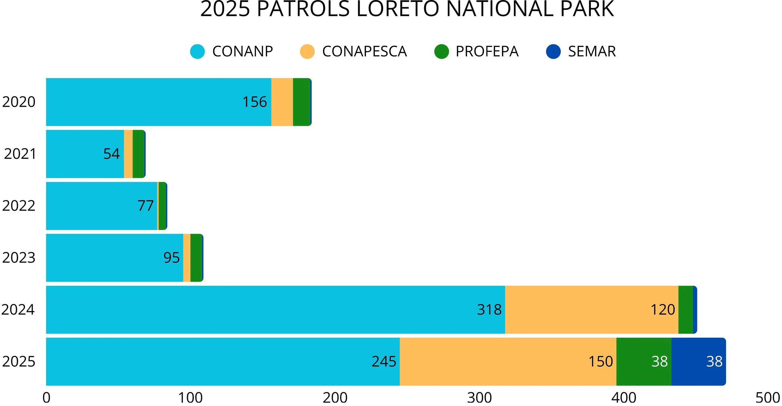
A comparison of combined patrols from 2020-2025 (CONANP LORETO - CONAPESCA) covered +18,000 km along 260,000 hectares.
Upgraded and supported with supplies for the GPD Command & Control Monitoring Center for Loreto National Park, including:
a) New batteries for radio-communication antenna solar system,
b) New no-breaker to avoid electric damage to the M2 system,
c) Replacement for a new power source to M2 system,
d) Rations and additional fuel for patrolling with CONAPESCA and CONANP
e) Supported maintenance of M3,
f) New AIS antenna.
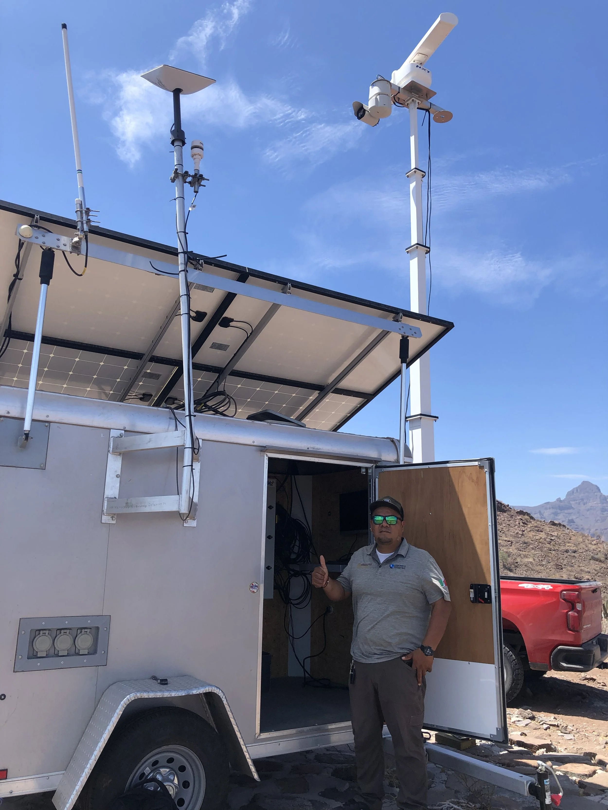
Upgraded to the M2 system with a new AIS antenna, regular M3 maintenance, and a new Radiocommunication power system (batteries).
3) Ongoing Agency Collaborations—Strengthening Inspections and Surveillance
The collaboration with CONAPESCA has yielded positive results in two key areas. Complement marine and terrestrial patrols jointly with CONANP rangers to prevent and to halt illegal activities along the coastline in Loreto NP, but also in buffer zones and support the surveillance outside boundaries of the National Park in critical areas such as fishing refuges and bays.
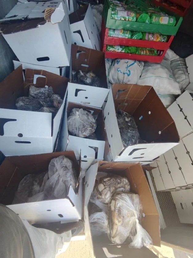
Successful interdictions by authorities resulted in 6 administrative complaints for illegal activities, 46 industrial vessels under inspection, multiple illegal fishing gears retained, including small boats and outboard engines, 200 tons of sardine back to the ocean, more than 650 kg of brown clam back to the sea, and more than 10,000 km patrolled by inspectors effectively protecting more than 165,000 hectares. Additionally, the officer supervised 9 sport fishing tournaments in 2025 in Loreto, conducting more than 380 prevention actions and spending over 1500 hours in the field.
Our support has been determined to ensure a permanent presence of fisheries officers by providing fuel, rations, and a space to rest and operate. This collaboration has scaled up along the corridor and allows for carrying out surveillance actions in a wider area, attending to the threats not just inside the National Park but also by discouraging illegal activities beyond park boundaries. CONAPESCA is quite interested in continuing with our collaboration and in maintaining and leveraging the engagement of additional agencies such as SEMAR in order to widen the area under protection and management, supporting the local surveillance committees in communities such as Agua Verde, El Pardito, and San Juanito.
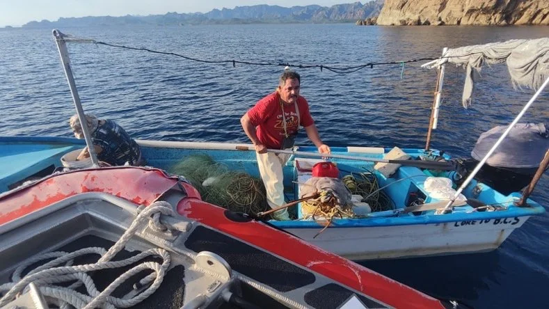
Nocturnal patrols and verification of artisanal fishermen in Loreto NP.
Official verification on commercial and industrial boats carried out by CONAPESCA officers and SEMAR.
In 2025, the CONAPESCA inspector started to record his patrols using the Earthranger logbook designed by the GC Director in Mexico in collaboration with our partners from Paul Allen Institute AI Earthranger, and providing technical support and assistance. This allows him to adequately conduct terrestrial and marine patrols in order to cover critical areas in space and in time.
Meaningful efforts were carried out to cover the coastal zone, including dirty rural roads, beaches, hidden entrances to the shore, and the city in order to avoid one illegal practice, the shore fishing of brown clams. This clam is under a kind of ban; there is no quota to fish this species due to overfishing. Currently, there is a plan to recover this emblematic fishery in Loreto, and this plan includes avoiding illegal fishing. Not less important is the marine patrol, wherein both CONAPESCA officers and CONANP rangers cover more frequently, such as distant islands in the National Park, and provide support to fishing refugees.
4) Support Interdictions, inspections, and marine protection on the Part of Authorities.
As we mentioned, GC recognizes the importance of supporting our marine national parks through effective marine protection by ensuring basic working conditions for law enforcement agents, park rangers, and community guardians. To achieve this goal, we are committed to building strong partnerships with those who share our mission to protect not only the most iconic places on Earth but also the environmental services they provide and livelihoods and to create a "social ecosystem" that enhances and shows the importance of protecting our marine resources.
In 2025, our resources were focused on providing lodging for enforcement agents and rations and fuel to ensure marine and terrestrial patrols. Equally, to maintain monitoring rooms under optimal conditions to keep remote surveillance active through the maintenance and upgrading of these strategic spaces, training rangers to read and understand the data that they are receiving 24/7, and keeping radio communication at all times.
CONAPESCA, CONANP rangers, and different units from the SEMAR have been actively involved in marine protection actions in Loreto National Park, Espiritu Santo National Park, Islas Marías Biosphere Reserve, and San Basilio. But, thanks to our partnerships, we are able to work with the SEMARNAT, the local representative office of the National Environmental Secretary in La Paz, in order to design a new site to monitor an increasing activity in the La Ventana and El Sargento area: the swimming and watching of Orcas (killer whales). We are collaborating directly with the SEMARNAT local office to ensure a new Earthranger logbook is shared with all the authorized tourist operators in the region to open a software solution to standardize and monitor such a particular activity.
Special collaborations with Central American national parks have been possible with the support of the Mary Jameson Foundation. The GC director in Mexico is actively supporting and assisting our colleagues from Coiba National Park in remote training sessions and follow-up performance of the Marine Monitor deployed during 2025, and linking our partners from ProtectedSeas and the National Park surveillance chief.

As part of our mission in Mexico, Islas Marías represents a unique site to be protected, and we worked for the last two years to accomplish limestone in marine protection in Mexico, to deploy the first Marine Monitor into a mexican island, and also to provide inputs and equipment to create a Surveillance and Remote Monitoring Room in the Islas Marías Biosphere Reserve.
This represents a significant advancement in marine conservation in the Mexican Central Pacific region, allowing enforcement agencies to access our Global Park Defense system. Currently, the Mexican Navy in Islas Marías, along with fishery inspectors from CONAPESCA and CONANP, as well as rangers, can log in to the M2 platform to easily detect potential targets, such as illegal fishing boats within the reserve, and take action to intercept and prosecute them. As a result, more than 50 illegal boats, commercial, artisanal, and sport fishing, were intercepted by the mexican navy jointly with the CONAPESCA officers on the island.
Islas Marías is becoming an interesting reference for how technology, smart patrols, and rapid interceptions work when authorities are committed and tech resources are on hand to ensure that the Outstanding Universal Value of this UNESCO Heritage Site is protected.
Inspections carried out by CONAPESCA and SEMAR within and outside the boundaries of Loreto National Park, coastal areas, and fishing refuges.
5) Deploying the First M2 system in the Islas Marías Biosphere Reserve.
After two years of negotiations and meetings, during 2025 Global Conservation, with the support of Pronatura Noroeste, deployed the first Marine Monitor on a Mexican island. Islas Marías is part of the UNESCO World Heritage Site Islands and Natural Protected Areas of the Gulf of California. Islas Marías is one of the largest No-Take Zones in the Central Pacific, covering 604,000 hectares. It constitutes the entrance to the Gulf of California, connected by marine currents, exporting biomass to other MPAs, and even acting as a source of coral species that travel to settle in Cabo Pulmo National Park.
Islas Marías sheltered many species of sharks, such as lemon sharks, tiger sharks, blacktip sharks, and nurse sharks; emblematic species, such as yellowfin tuna and striped marlin; and culturally important species, such as the purpura shellfish, which is highly threatened by illegal fishermen.
If we want to protect the Gulf of California, we need to protect Islas Marías, and Global Conservation focused on deploying our Global Park Defense Marine, and this included:
I. Deployment of the first M2 in the north of Isla María Madre,
II. Installation and connection to an off-grid solar power system,
III. Training to rangers, CONAPESCA, PROFEPA and military personnel,
IV. Access to the system and camera
V. Initiation of an Earthranger site and logbook with the support of the ER team based in Mexico
Thanks to this deployment, the marine reserve is able to remotely supervise almost 90,000 hectares in the northern portion of the island, protecting the pelagic environment where species such as tuna and marlin are present and are the targets of illegal fishing (sport and commercial).
The CONAPESCA officers and the Mexican Navy have successfully intercepted at least 68 commercial and sport fishing boats. All those boats were detected thanks to the marine monitor and were supported with an amazing rapid response protocol implemented by the enforcement agents, including the military personnel.
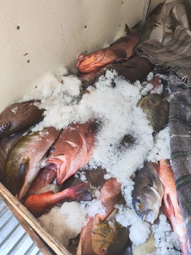
More than 1.5 tons of illegal products (bonefish and shellfish) have been seized by authorities, and poachers were prosecuted by CONAPESCA officers. To date, it is possible to watch a dramatic decrease in activity related to fishing, ensuring the protection of pelagic and rocky reefs in the northern portion of the marine reserve.
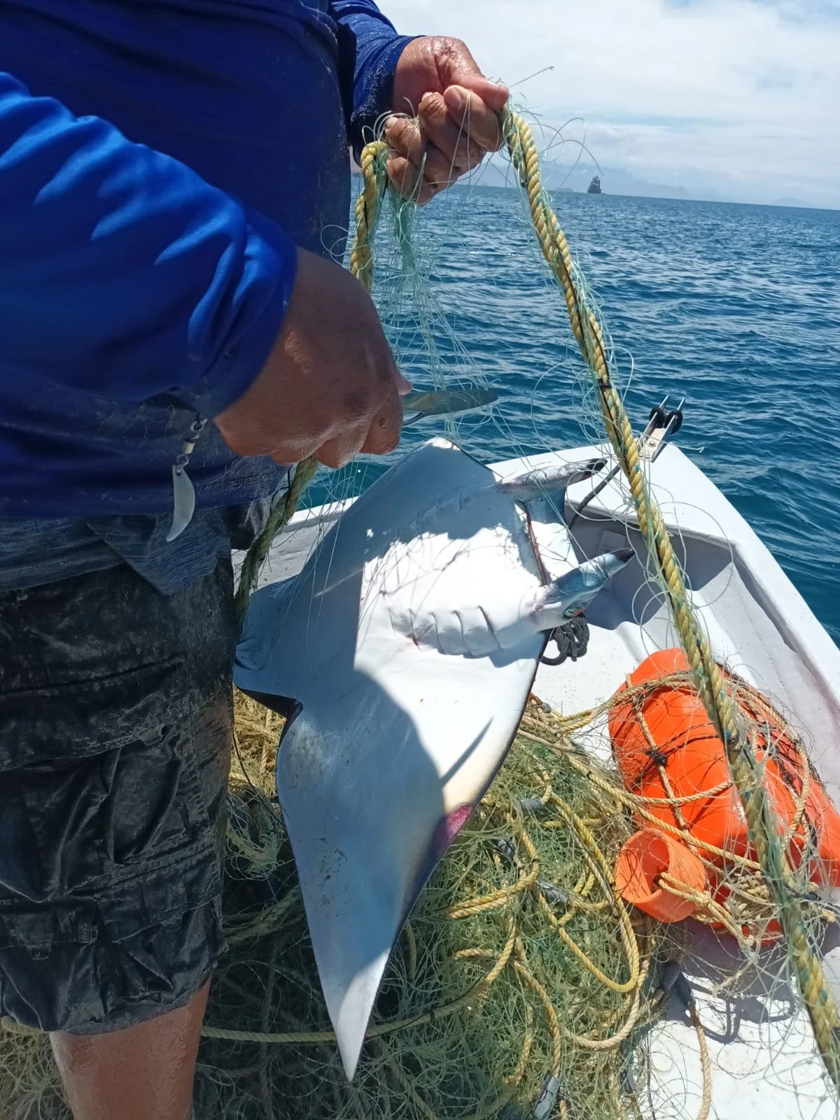
A mobula ray is caught in the net of a poacher.
Overfishing remains a persistent problem in protected areas.
Islas Marías M2's first-half semiannual report and 3rd quarter report, respectively. The results show an important decrease in alarms in the area, from 217 to 44, as a result of a significant patrol and enforcement effort to deter illegal fishing in the area of San Juanito Island and the northeast portion of María Madre Island.
We are expecting to raise funds to co-finance a second Marine Monitor in the southern island at Islas Marías, Isla María Cleophas. With a second M2, the reserve will be able to detect and deter illegal poachers coming from Puerto Vallarta, Cruz de Huanacaxtle, and Bucerias, mainly to poach shellfish and tuna.
In Conclusion
The MPAs have successfully adopted Global Park Defense for marine protection, and local partners have also embraced some of its components. Thanks to the MoU signed between CONANP and GC, we are moving forward more quickly to achieve our goals and to promote and support marine protection in Baja Sur and the Central Pacific. Oceana seeks our assistance in marine surveillance in the Gulf of Mexico and Yucatan, reflecting a positive perception of Global Conservation’s work in Mexico.
None of this would be possible without the support of the funders, like the Mary Gard Jameson Foundation, that support Global Conservation's work around the globe.
We deeply acknowledge the Mary Gard Jameson Foundation for your support, which made these successes along 2024–2025–2026 and helped establish a strong foundation for next year's Global Park Defense and Community Protection program.