
Global Conservation Funds Fighting Fires with New Technology in Costa Rica
Update: 06/20/25The Guanacaste Conservation Area in Costa Rica implements unique technology in Central America to protect biodiversity: smart cameras monitor the ACG.
Guanacaste Conservation Area in Costa Rica is leading the way in environmental monitoring and response to threats like illegal hunting and forest fires. They have installed smart camera surveillance, a state-of-the-art monitoring technology, which is already helping to protect ecosystems.
Thanks to the support of Global Conservation, this technological tool has been brought to the heart of one of the country's most important conservation areas—the dry forest—and its most delicate ecosystems. Local authorities and park rangers have worked closely with Global Conservation to make this implementation possible.

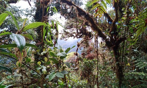
Various ecosystems, including as tropical dry forests, mangroves, coral reefs, beaches, and rainforests, make up the ACG, which is situated in northwest Costa Rica. It stands as a testament to the nation's remarkable achievements in preserving and restoring its natural resources; it is home to over 400,000 species, which accounts for around 2.6% of the world's biodiversity. The biological resilience of this region and the survival of thousands of species depend on its protection from the effects of climate change.
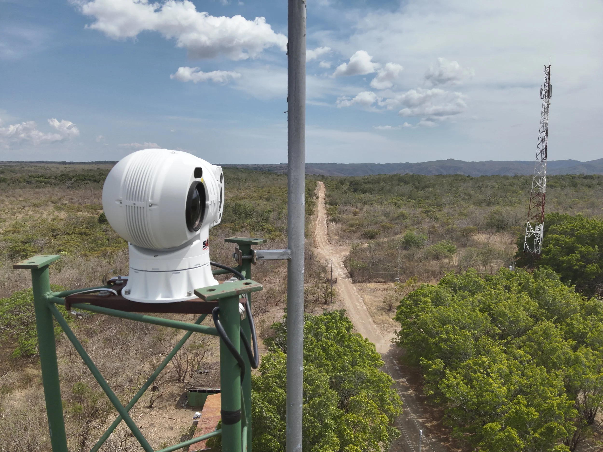
The ACG is a crucial area for Costa Rican biodiversity and a UNESCO World Heritage Site. This camera combines thermal imaging, high-definition vision, and laser night vision, allowing for continuous, autonomous monitoring in distant locations without human intervention.
Forest fires have been extremely rare this year. Park rangers' patrols and surveillance have been supplemented by this new tool, which has been instrumental in keeping the number of hectares affected below 100, according to Marco Bustos, Director of Protected Wilderness Areas and coordinator of the ACG's Fire Management Program.

Technology to anticipate fire and threats
The high-precision thermal sensor is one of the key features that allows this monitoring system to identify hot spots prior to the appearance of a fire. Because of this, rescue workers have been able to head off crises that may have quickly worsened due to the region's arid climate.
Also, with its zoom and automatic tracking technology, the camera can watch a fire's progress in real time, which helps in making strategic decisions about what to do. Its ability to work with alert systems means that control centers can receive notifications instantly, which further decreases reaction times.
Its utility, however, extends beyond the realm of fire. Because of its AI system, which can differentiate between humans, animals, and other environmental factors, the camera has also demonstrated its ability to identify various forms of motion and the presence of unauthorized humans. Because of this, monitoring can be more accurate and flexible, increasing its usefulness in protecting biodiversity.

Global Conservation Drives Innovation for Conservation
This technology's presence in the ACG is a testament to Global Conservation's dedication to bolstering ecologically significant places' control and conservation of their resources through technological solutions.
When other protected areas in the area face similar problems with access, monitoring, and quick response, the organization, Costa Rican officials, and ACG teams work together to develop a model that can be replicated.
"It's a clear example of how technology becomes a strategic ally to facilitate fieldwork and strengthen surveillance, without replacing the knowledge or commitment of personnel. On the contrary, when combined with human experience, it generates even more valuable potential," added Marco Bustos.
Thanks to this integration, the ACG is able to further its position as a leader in environmental conservation. By using state-of-the-art techniques, it can respond faster to risks and discourage unlawful activity, ensuring that its biodiversity is protected for generations to come.

Through thermal imaging utilizing powerful camera technology, fires created by climate change or poachers will now be much more easily detectable, which means faster response to stop them from spreading.

A New Era of Fire Detection
Global Conservation has completed the installation of a camera and fire monitoring system in the Guanacaste Conservation Area, along with a control center. This milestone now allows GC to move forward with the radar.
Marco Bustos, who leads the Control and Protection Program, is currently preparing a map highlighting key hotspots and priority zones within the marine area. The data will help us resume the conversation around identifying the most suitable site—or sites—for radar installation in the protected area.
Forest fires are a significant threat to our natural environment, wildlife, and human settlements. These devastating blazes claim thousands of acres every year, causing lasting ecological and economic damage. Early detection and prevention are crucial for minimizing the impact of these fires. One of the most effective tools in this fight is the thermal imaging system. This technology has revolutionized how forest fires are monitored, detected, and controlled. Here's how thermal imaging systems are contributing to a safer and more sustainable world.
The Guanacaste Conservation Area protects one of the last remaining tropical dry forests in Central America, a unique ecosystem that has been restored and preserved over the years. Covering approximately 80,000 hectares, this forest hosts a wide diversity of flora and fauna adapted to extreme drought and seasonal rainfall conditions, serving as a vital refuge for endemic and endangered species.
This project is essential for maintaining the conservation connection between Costa Rica’s four main ecosystems: the marine ecosystem, the dry forest, the humid forest, and the rainforest. The integration of these systems is key to ensuring the sustainability and protection of our biodiversity.

How Thermal Imaging Systems Work
Thermal imaging systems detect heat by capturing infrared radiation emitted by objects. Every object emits some level of infrared radiation, which increases with temperature. Thermal imaging systems can identify temperature differences that are invisible to the human eye. In a forest environment, this means detecting early signs of abnormal heat buildup, such as smoldering vegetation or hot spots, which may indicate a potential fire hazard.
These systems work effectively both day and night, regardless of weather conditions. Unlike traditional surveillance cameras, thermal imaging is not hindered by darkness, smoke, or dense foliage. This makes it an indispensable tool for early fire detection, allowing rapid response before a small spark turns into an uncontrollable wildfire. Raytron offers advanced thermal imaging solutions that enable accurate and early detection of potential forest fire hazards, ensuring timely preventive measures and effective monitoring.

The station shows its monitoring system across the Guanacaste Conservation Area.
Advantages of Using Thermal Imaging for Forest Fire Prevention
High Accuracy and Reliability
Thermal imaging systems offer precise data with minimal false alarms. Unlike visual inspections, which can be subjective and limited by environmental factors, thermal data is more consistent and reliable. This accuracy is crucial in large forested areas, where rapid detection is key to preventing widespread damage.
Cost-Effectiveness in the Long Run
While the initial investment in thermal imaging technology can be significant, the long-term benefits outweigh the costs. Early detection reduces the scale and expense of firefighting operations, lowering the financial burden of fire damage repairs. Additionally, thermal imaging contributes to reducing insurance costs for at-risk regions by minimizing the likelihood of catastrophic fires.
Non-invasive and Environmentally Friendly
Thermal imaging is a non-invasive method that does not interfere with wildlife or the natural environment. It operates passively, using heat signals to detect potential hazards. This makes it an ideal solution for monitoring sensitive ecological zones without causing disruptions or additional environmental impact.

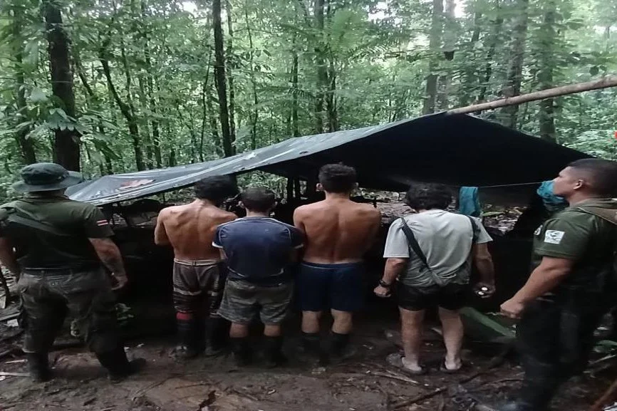
Cattle ranching is a major driver of forest fires in order to clear land for the cattle itself.


Marco Bustos Salazar, a park ranger and conservation leader from the Área de Conservación Guanacaste (ACG) in Costa Rica, recently completed a specialized course on protected area management led by Jim Barborak from Colorado State University.