Ecoguards Arm Themselves with Technology to Protect Peru's Manu National Park
Indigenous communities settled in the buffer zone of Manu National Park have reported land grabs and the constant presence of coca growers and drug traffickers.
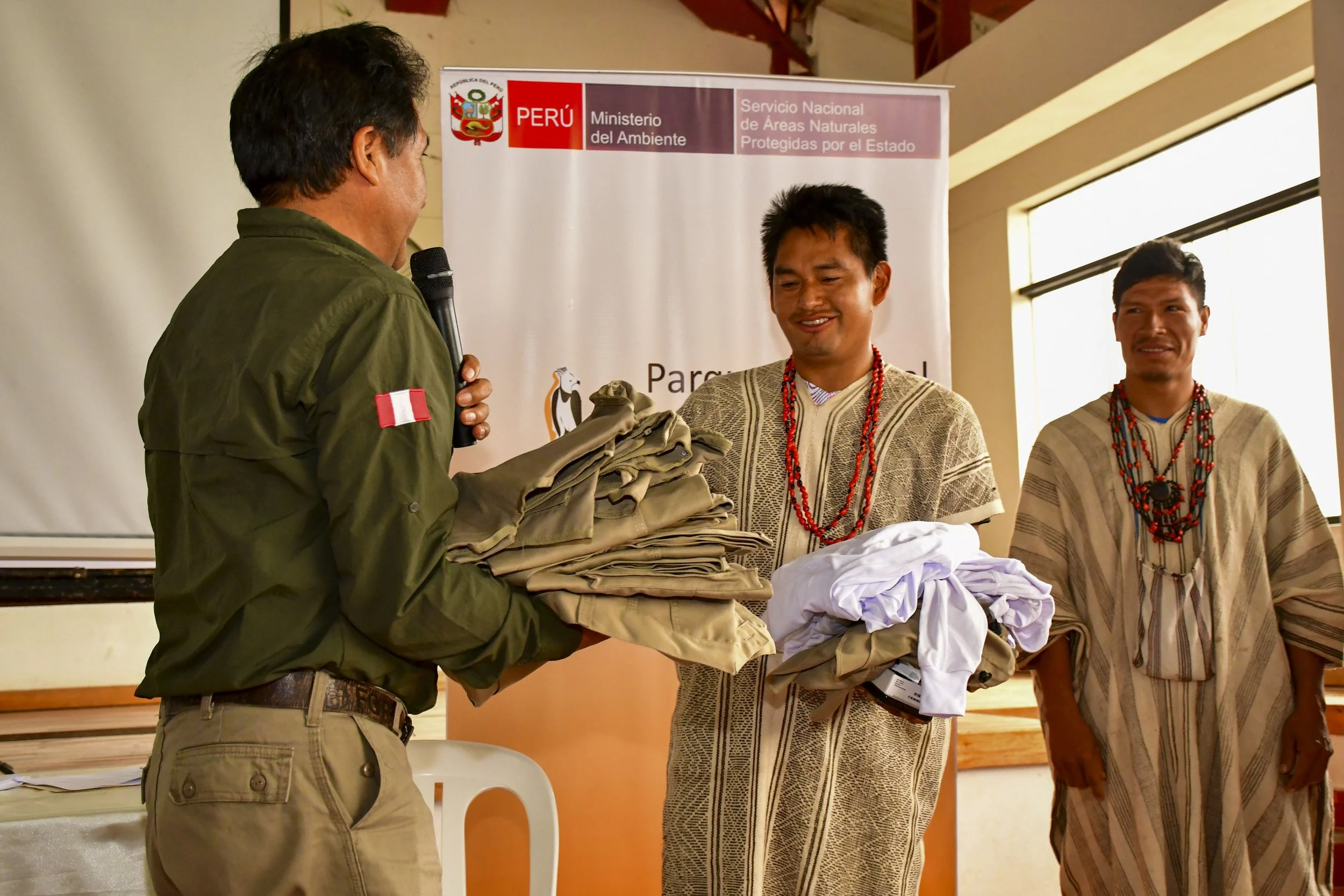
Residents of three communities will be trained as eco-guards and trained to monitor their forests using technology and, consequently, the protected natural area.
The Directorate of Amazonian and National Surveillance, a unit of the Peruvian Air Force, flew over part of the affected areas and found expansion of deforestation and coca plantations.
In Santa Rosa de Huacaria, in the Peruvian jungle, the Machiguenga and Huachipaire community members seem to measure time in terms of the amount of territory they have usurped or recovered. If they look back to an important event, their first reference is how much land they had invaded at that time and how they regained control of it. Manuel (*), one of the community leaders, says that 10 years ago, more than 20 hectares of the Santa Rosa de Huacaria forest were deforested by non-indigenous invaders settled on the banks of the Piñi Piñi River. Five years later, 10 more hectares were destroyed on the border of the town with the Manu National Park. Until now, the organized population has been able to dissuade the invasion attempts that, according to Manuel, are linked to the expansion of illegal coca crops. However, the threat to Santa Rosa de Huacaria remains constant, just as it does for other communities that border the protected natural area.
Of the 36,806 hectares of titled land in Santa Rosa de Huacaria, 70% has been superimposed on the Manu National Park since the protected area was created in 1973. Some 50 families dedicated to agriculture and fishing live in this indigenous community located in the Cusco region.


Together with Palotoa Teparo, Shipetiari, Diamante, and Isla de los Valles, Santa Rosa de Huacaria is part of the group of indigenous communities located in the buffer zone of the national park, between Cusco and Madre de Dios. The Carbón River runs along the border between both regions. This is a turbulent area due to territorial disputes and is marked by the risk posed by the presence of coca growers and drug traffickers. Therefore, Santa Rosa de Huacaria has strengthened its indigenous communal guard in recent years.
“Foreigners are looking for land in our communities under the pretext of farming. But, in the end, it is to grow coca. That is why we do not allow them to stay. We act immediately,” the community leader told Mongabay Latam.

According to the latest report from the National Commission for Development and Life without Drugs (Devida), Peru has 92,784 hectares of coca leaves. Although, according to the Devida study, the Manu National Park does not have coca crops, 1,025 hectares of illicit crops are spread throughout its buffer zone. This is 66 hectares more in this protection belt of the park than in the previous measurement, which reported 959 hectares of coca fields. In other words, the pressure on the communities near the Manu National Park and the natural area itself is steadily increasing.
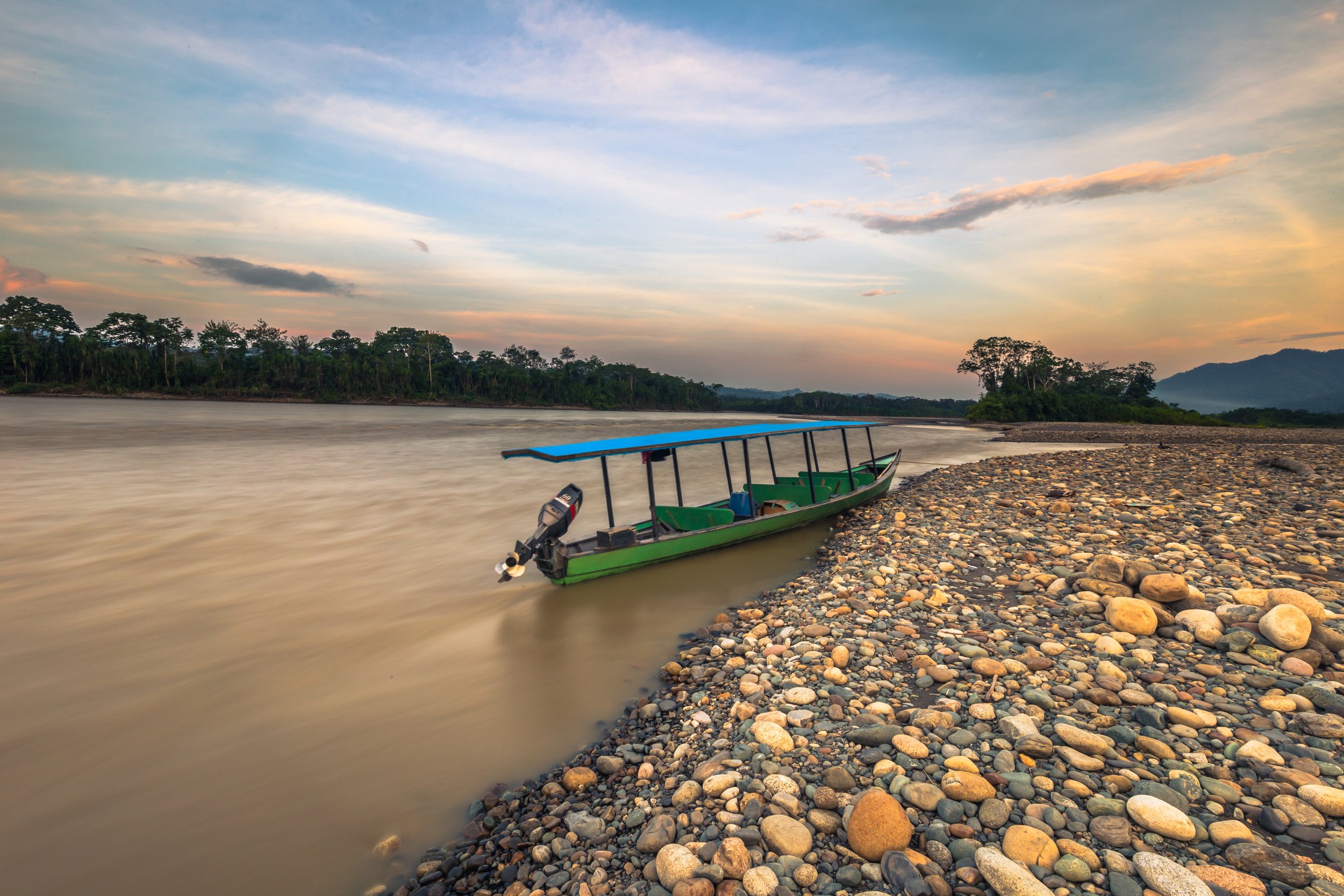
Diamante is located within the buffer zone of the Manu National Park. Photo: courtesy of community members.
The Manu National Park covers more than 1,716 hectares of highly diverse flora and fauna. Its natural wealth is made up of, among other variables, more than 1,000 species of birds and hundreds of species of mammals, reptiles, amphibians, and fish. It also has a great variety of forests in which cedar, Tornillo, Lupuna, and Brazil nut trees stand out. A complex hydrographic system and the Tayakome and Yomibato communities, with their Maizal and Cacaotal annexes, respectively, extend across the park. In addition, there are Mashco Piro populations living in voluntary isolation and Machiguenga populations living in initial contact. All of this underscores the immense significance of the protected natural area and the importance of its conservation.

The towns near the Alto Madre de Dios River are the ones that are most under pressure from invasions and the presence of drug trafficking. Photo: courtesy of community members.
Alert in Palotoa
Margarita's face (*) changes when she tries to calculate how much of the territory requested as an extension by Palotoa Teparo is occupied by settlers, non-indigenous people who broke into the native community to stay. She lives in the area and has seen how in recent years the situation of Palotoa Teparo, a Machiguenga population with a surface area of 6,182 hectares titled and a request for 13,000 hectares of territorial extension pending for 20 years, has worsened.
"We don't know how much space they occupy, but it's a lot. They are already clearing the forest and building a shelter," he says, frowning.
The invaded territory is becoming a bigger mystery for the Palotoa Teparo community members. In recent years, when they tried to enter to report that there was a request for title to that land that had yet to be resolved, the usurpers demanded that they show titles or documents that accredited them as owners and, finally, they threw them out with threats.
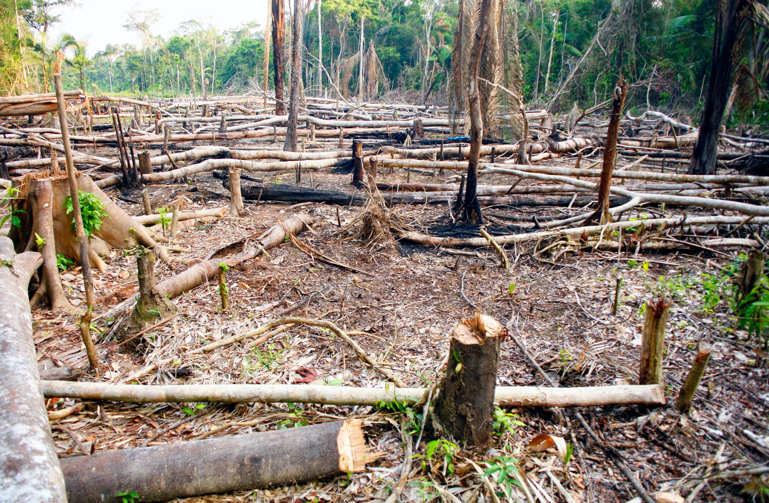
“Slash and burn” deforestation is prevalent in Peru, which is later used for coca plantations.
For this reason, they are not clear about the current size of the invasion or the amount of forest they have lost. Nor are they clear about whether there are now coca or other crops in that area. What they do know, and what worries them, is that deforestation continues and there is no effective control by the authorities: “The prosecutor's office has gone several times, but they only confiscate the chainsaws and that's it. Then the settlers get new chainsaws and continue cutting down. And so the cycle repeats itself.”
She tells Mongabay Latam that the critical area of Palotoa Teparo is not the one that borders the Manu National Park, although over time it could generate pressure on that sector. For the moment, the organized community accompanies the patrols that the park rangers of the National Service of Natural Protected Areas of the State (Sernanp) carry out on the border with the national park. There are 38 families who live in Palotoa Teparo, under the protection of a surveillance committee that will receive training for monitoring their forests by the international organization Global Conservation, in coordination with Sernanp.
The eco-guard training program involves training in the use of the EarthRanger system, which collects real-time information on deforestation, crops, and the presence of animals or people within protected natural areas. It will be delivered in three communities located in the belt surrounding the Manu National Park: in addition to Palotoa Teparo, Santa Rosa de Huacaria and Shipetiari will participate. This forest control scheme is already being applied in indigenous populations located in the buffer zones of the Sierra del Divisor (since 2019) and Otishi (since 2023) national parks in order to counteract the advances of illegal logging, illicit coca crops, and territorial invasions.
“Historically, the neighboring communities have been supporting the care of the park. They are a kind of voluntary guardians. They are the ones who know the territory best, and their ancestral knowledge will be combined with technology for the protection of the space,” says the head of the Manu National Park.


The concerns of the community members and administrators of the protected area are well-founded. The sub-prefect of the province of Manu (Madre de Dios) has five complaints of threats against indigenous community members in his records during the last year. Three were dismissed because they did not have the supporting evidence attached.
The sub-prefect explains that when the complaints are directed against someone in particular (by name), they must have at least one piece of evidence to support them. “This is very difficult to obtain in the communities, so we are forced to dismiss the complaint and the aggressor is emboldened. But we have a directive to follow,” he points out. For the case to proceed and for protective measures to be granted, he specifies, the accusation must include the phrase “against those found responsible.”
Due to the difficulties in obtaining personal guarantees, in addition to the growing danger in the indigenous communities of Manu, the provincial sub-prefecture is coordinating with the Public Prosecutor's Office to issue a rapid response protocol for human rights defenders. A tool that would allow, for example, the risks of indigenous defenders to be addressed within 24 hours after the complaint.
Threats in Shipetiari
One of the cases that did proceed, since the accusation met the requirements, took place in the native community of Shipetiari, another of the indigenous communities that is in the buffer zone of the Manu National Park and whose communal guard will also be trained in the use of tools for monitoring the territory.
In July 2024, armed invaders detained and threatened 17 community members who were accompanying a state technical team in charge of territorial georeferencing for the expansion of the community, reprimanding them not to continue with the process.
Indigenous communities such as Diamante, near Alto Madre de Dios, are among those most exposed to danger. Photo: courtesy of community members.

Indigenous communities such as Diamante, near Alto Madre de Dios, are among those most exposed to danger. Photo: courtesy of community members.
The 17 Machiguenga inhabitants obtained personal guarantees (the Mechanism for the Protection of Human Rights Defenders), among them, Gerardo Keimari Enrique, a resident who continuously supported the work of the Shipetiari Surveillance and Control Committee.
In early October 2024, after several weeks of intimidation that he reported among his relatives, Gerardo Keimari was found dead on the banks of the Madre de Dios River, near his community. The case remains under investigation.
The sub-prefect crosses his arms and hardens his voice: “So, there were problems with the invaders and then, suddenly, a dead person appears. That raises suspicions and is very worrying.”
However, for a Shipetiari leader, the matter is clear. The only possibility he considers in the face of the murder of Gerardo Kemiari is that of retaliation for the complaints against the invaders who attacked the 17 Machiguengas in July 2024. “Now we can no longer reach the area where we have a request for expansion because we risk our lives,” he said in December.

The Shipetiari native community is another of the indigenous peoples that is in the buffer zone of the Manu National Park. Its communal guard will also be trained. Photo: courtesy of community members.
The head of the Manu National Park points out that, although there are no illegal crops or clandestine landing strips there yet, these are concentrated on the banks of the Alto Madre de Dios River, which meanders through the buffer zone of the protected natural area. During the Amazonian summer, the wide riverbed and its contours constitute a space conducive to the layout of illegal airfields: the level drops until it dries up and enormous sandy beaches emerge where drug trafficking planes land.
Indigenous communities such as Diamante and Shintuya, close to Alto Madre de Dios, are the most exposed to danger. Of the two, Diamante is located within the buffer zone of the national park. Shintuya is not, but it borders Palotoa Teparo and its position is quite close to the protection zone of the natural area.
The lifeless body of Gerardo Keimari, a Shipetiari community member, was found on the banks of the Madre de Dios River in October 2024.
Emergency zones
The Directorate of Amazonian and National Surveillance (Divan), a unit of the Peruvian Air Force (FAP), as part of an agreement aimed at protecting the Manu National Park, conducted an overflight of 9,000 hectares of the buffer zone of the Manu National Park. What was found were 408 hectares of deforested forests. On 83 of them, there are illicit coca leaf crops.
The assessment reveals an increase of 107 hectares of forest depredation in the areas analyzed in the last four years, as by 2020 deforestation had amounted to 301 hectares according to satellite images in that year.
Some of the hotspots are in the vicinity of Pilcopata, Itahuanía, Shintuya, and Diamante, south of the Manu National Park. One of the military unit's conclusions is that the overflight area not only shows a continuous growth of illicit crops but also a population increase, since several rustic and non-indigenous dwellings were detected during the evaluation.
Within the 25,442 hectares of Diamante's territory, there live some 300 Yine community members. Diamante, in the Madre de Dios region, borders Shipetiari, the Manu National Park and the Amarakaeri Communal Reserve. The community has a post for the control and surveillance of the Mashco Piro tribes that inhabit the national park.
For them, the Yines have also set up a weekly food delivery program. But in Diamante, drug trafficking is gaining ground every day.

Diamante is one of the most troubled communities within the buffer zone of Manu National Park.
The first thing Teófilo (*) asks is that, for safety reasons, we do not call her by her name. He, who frequently travels around the area, estimates that at least twice a week you can hear the landing and taking off of planes at Diamante airport when you are near the area, in the forest. He says that the community's airfield is taken over by drug traffickers and that has turned Diamante into a transit point for drug networks.
“A few years ago, the community fought back and was able to recover the airport. Drug traffickers came into the community to offer money to rent it to them, and when they refused, they took it by force,” he says.
The community airfield is about a 40-minute motorbike ride from the urban area of Diamante and, as in other landing strips deep in the jungle, the mafias load the planes with the drug packages in less than two minutes. After a breath, the source details that there are different criminal organizations that use the Diamante airport, that they are all in conflict and, therefore, each one must have a cordon of armed men around the runway to prevent robberies or attacks by their rivals.
The source says that the illegal merchandise comes from towns near the buffer zone of the Manu National Park, such as Itahuanía, Patria, and Pilcopata. He knows that coca crops are widespread in those areas and is convinced that Diamante does not host large-scale illegal crops. He recognizes, however, that it is a strategic site for drug trafficking networks that attack even from the valley of the Apurímac, Ene, and Mantaro (Vraem) rivers.
“The shipments are to Bolivia; from there they distribute to Brazil and other countries. In some cases there have been serious shootouts between gangs. If there are massacres, nobody says anything. There is no law. It is just there,” he says.

Diamante could be part of a second stage of training eco-guards for the control of forests and the Manu National Park. Photo: courtesy of community members.
Another man, Mario (*), who knows the area very well, says that he has found several corpses during his searches through the forests of Itahuanía. If someone, even by chance, is detected observing the movement of drug traffickers, he says, they can either kill them immediately or threaten them forever.
Fear, the need for money and the serious lack of attention from the state have all come together to make the inhabitants of this part of the Peruvian Amazon agree to cooperate with drug networks. This is emphasized by Mario (*); he suddenly dissipates the tension a little and adds, “One way or another, it is a system from which they cannot escape. Sometimes it is better to be their friend; they have no qualms about pulling the trigger.”
He does not specify the location; he says he does not remember exactly where or perhaps he is holding back in a sudden fit of distrust, but he assures that in Itahuanía there is also a clandestine landing strip where drug trafficking operates constantly.
In an effort to prevent the violent advance of crime from continuing, Diamante has formed a surveillance committee that must patrol various points of its territory on a monthly basis and report any evidence of threats found.


Technology for conservation
In November 2024, Global Conservation installed Internet service in the three indigenous communities bordering Manu National Park that will receive training in using the EarthRanger system. The workshops will begin at the end of this month (February) and aim to train six ecoguards for each selected community: Santa Rosa de Huacaria, Shipetiari, and Palotora Teparo. The estimated global area of the three indigenous sectors in which the project will work is 55,000 hectares.
Teddy Cairuna, a forest monitor for Global Conservation in the Peruvian Amazon, notes that all the real-time data that the eco-guards collect during patrols in their territories will also be recorded in the system's files, which will also be accessible to authorities with jurisdiction in the environmental field.


“Any information collected by an eco-guard will always fall into the right hands,” describes Danny Zendejas, partner manager for Latin America and the Caribbean at EarthRanger.
The onslaught of each territorial threat has already surpassed the capacities of the communities to defend themselves in the traditional way. Technology and its application can contribute to the exact identification of the problem, but everything will always be more complex without a rapid and effective response from the authorities. The path to the protection of the Manu National Park, through forest control in its neighboring villages, can outline a more complete strategy or mean an urgent first step.
*Some names have been changed or not revealed for security reasons.