
GC News and Progress
Explore Our Upcoming Events or GC In the News Here
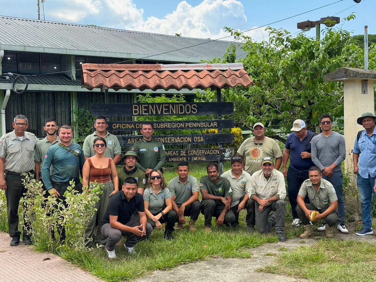
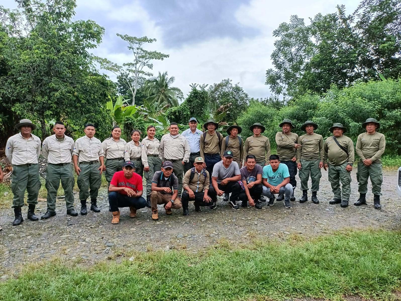
Global Conservation hosts GC Summit: Corcovado to Share Best Practices in Park and Wildlife Protection
Summits focus on emerging strategies for protecting national parks worldwide, including incorporating advanced technologies and community-based approaches for conservation. Summits include workshops, knowledge-sharing sessions, and collaborative policy discussions to enhance park management.
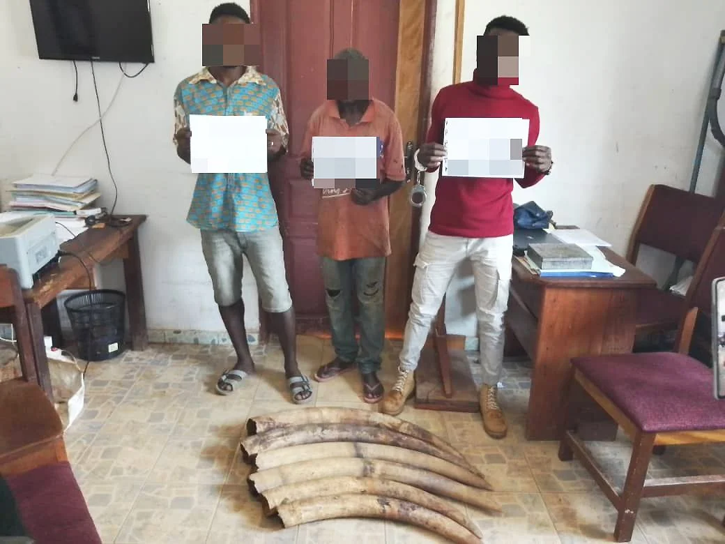
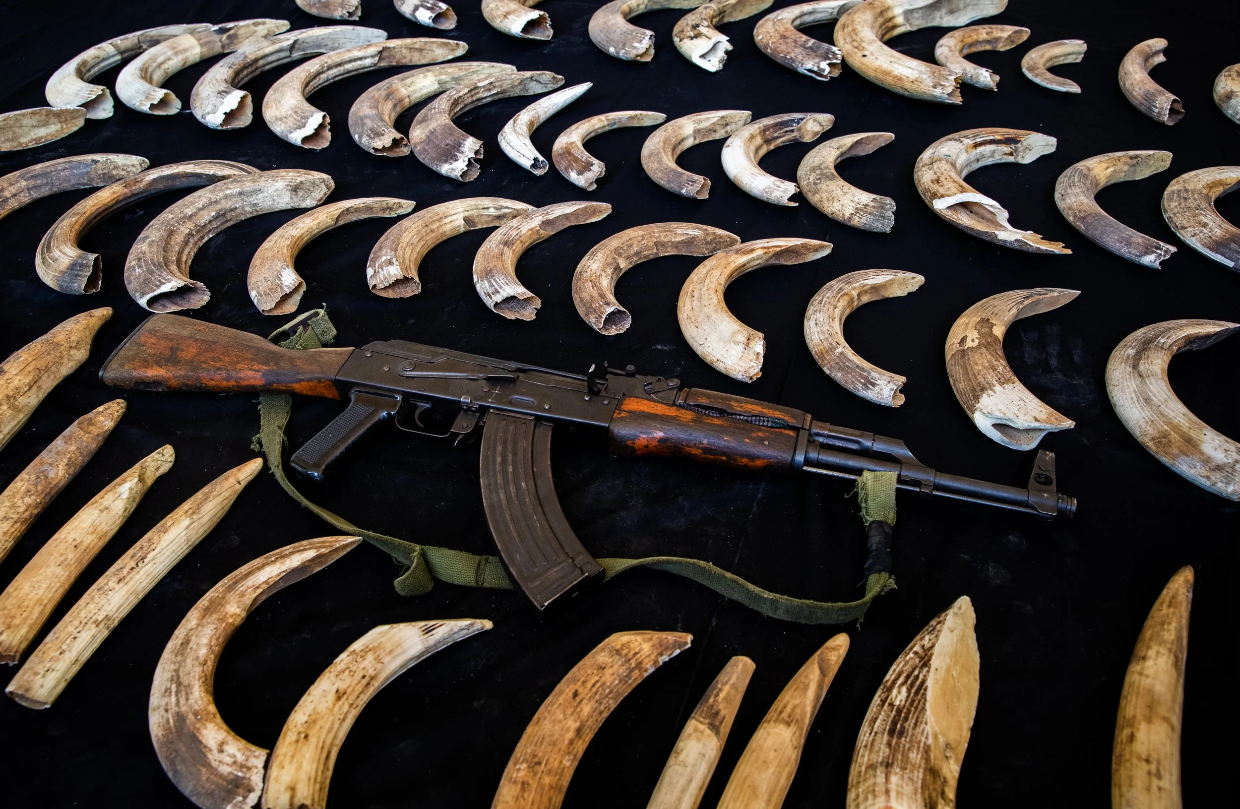
Law Enforcement Support Project on Wildlife in Gabon
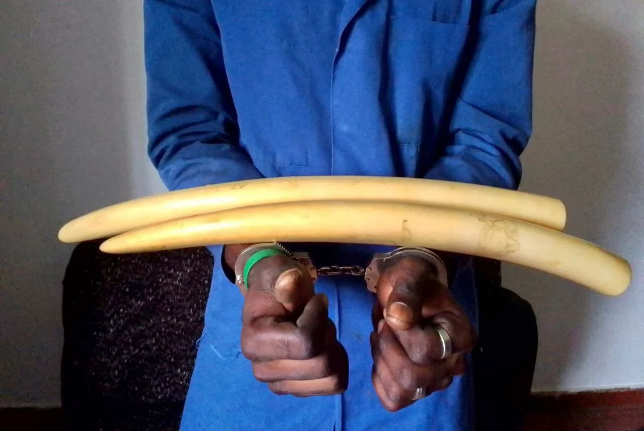
The AALF Project (Support to Wildlife Law Enforcement) has been implemented by Conservation Justice since 2010 through a partnership with the Ministry of Water and Forests. This report presents the outcomes of a year-long fight against wildlife trafficking carried out throughout Gabon.
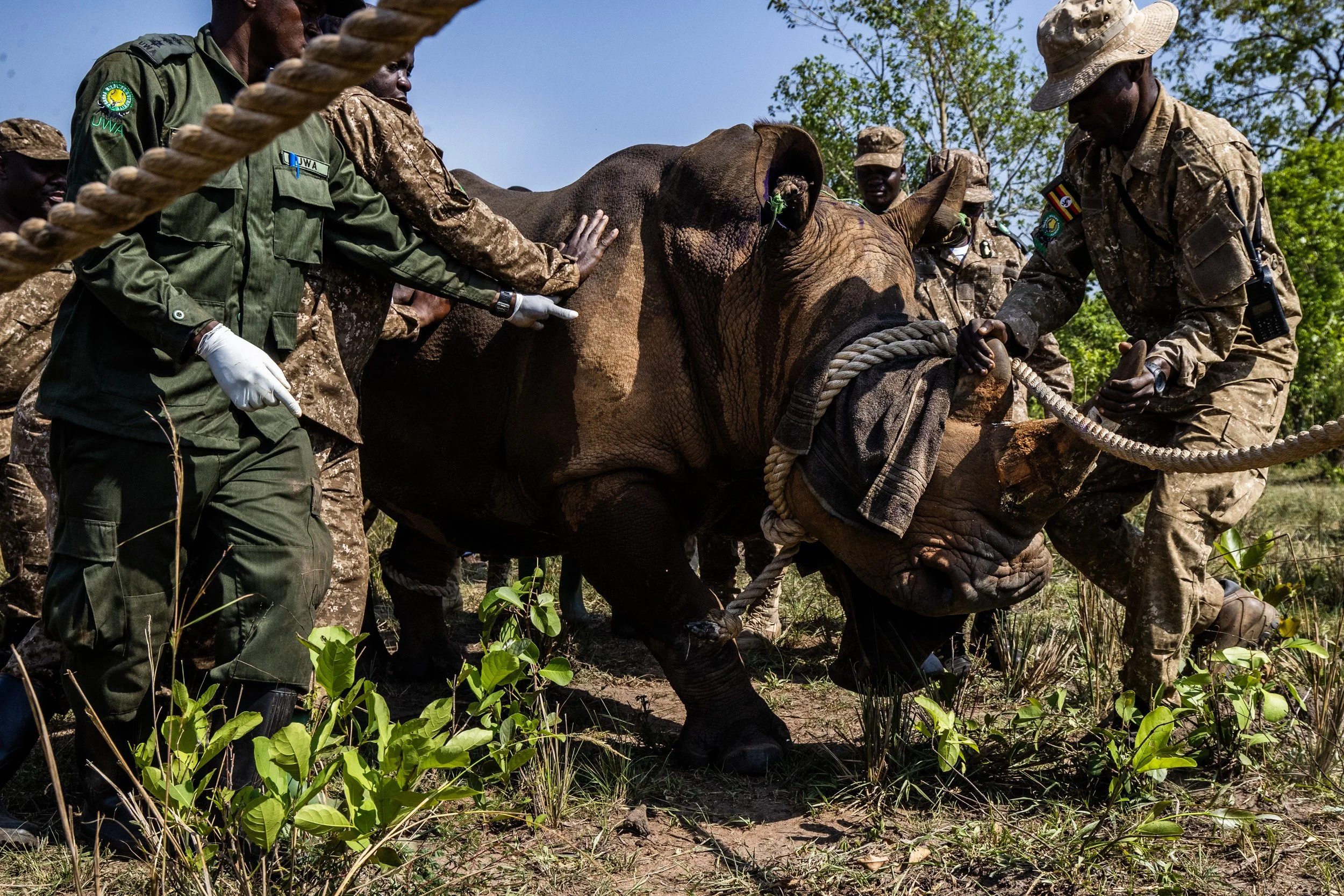
Making History—GC Rhino Reintroductions in Uganda featured in BBC News, AP, and More
Ugandan wildlife authorities have reintroduced rhinos into a remote protected area where they were once poached into extinction, an event seen by conservationists as a milestone in efforts to support the recovery of a species threatened by poaching.
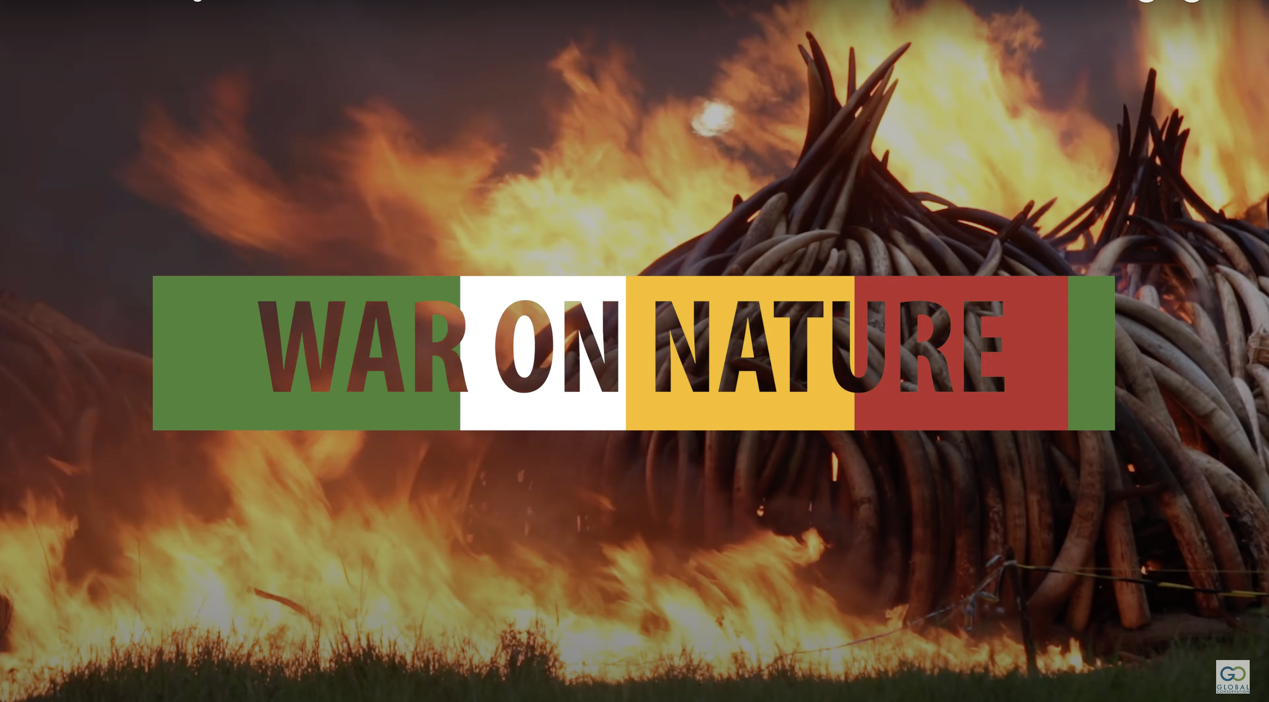
GC Hits Major Milestone: 5 Million Youtube Views
Global Conservation started its video production journey into short films seven years ago, but the rise in viewership drastically changed within the last two years, starting with the very first introduction of the War On Nature (WON) series with internationally renowned photojournalist Paul Hilton.
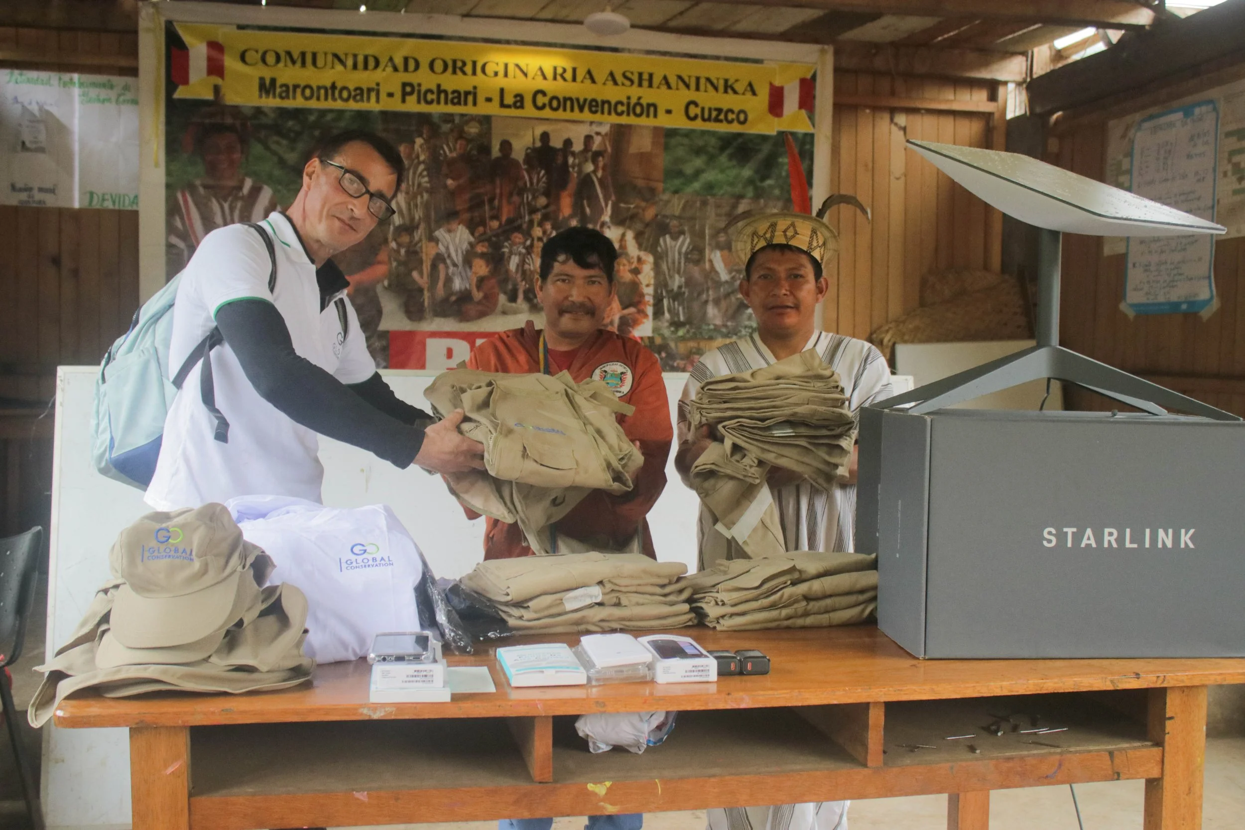
Indigenous Community Protection – 2024-25 Naso Comarca, Northern Panama
Global Conservation has received critical funding from the Alumbra Foundation to support National Park and Community Protection of the Naso Indigenous Territory, the largest legally established Indigenous Comarca in Panama (160,616 hectares).
The Naso have organized a 60-member Community Protection team responsible for demarcating, monitoring, and patrolling their territory.
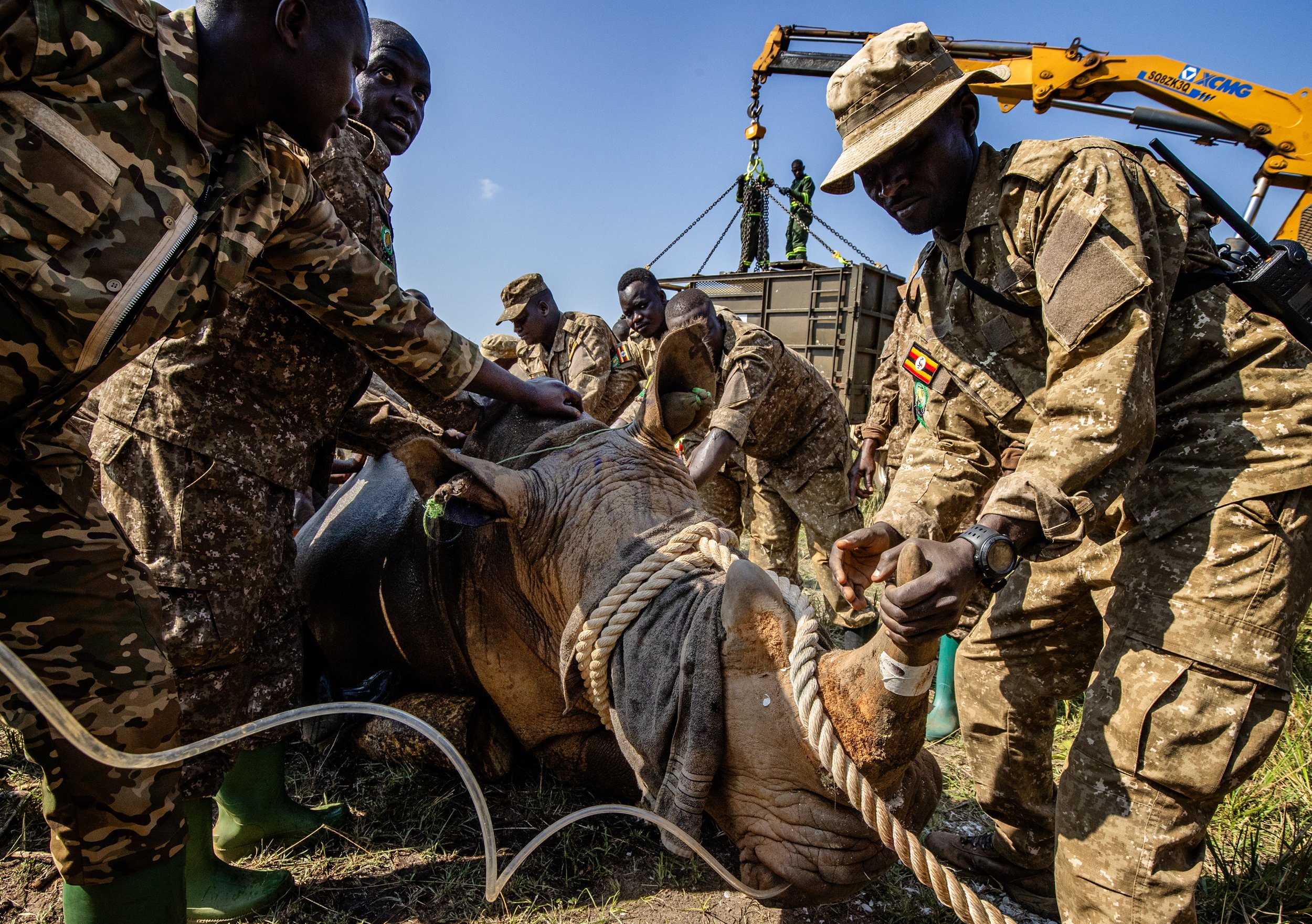
Breaking GC News: BBC and Reuters Covers GC Rhino Reintroduction in Kidepo Valley NP Uganda
In a historic moment, rhinos are released back into the wild at Kidepo Valley National park in Uganda. Global Conservation is on-site on behalf of the Uganda Conservation Foundation, which supports the Uganda Wildlife Authority to protect Uganda’s wildlife and stunning landscape. Global Conservation has been funding parks across Uganda for over seven years; this event is a massive day for rhinos and everyone involved.
Global Conservation’s Indigenous Lands Protection
Indigenous peoples are, and have always been, a significant answer to the entire climate change problem, as their traditional practices promote biodiversity, enhance carbon sequestration, and maintain ecosystem resilience against climate impacts.
Global Conservation’s Indigenous partnership initiative is leading our Community Protection program that effectively prevents illegal logging, poaching, and land grabbing.
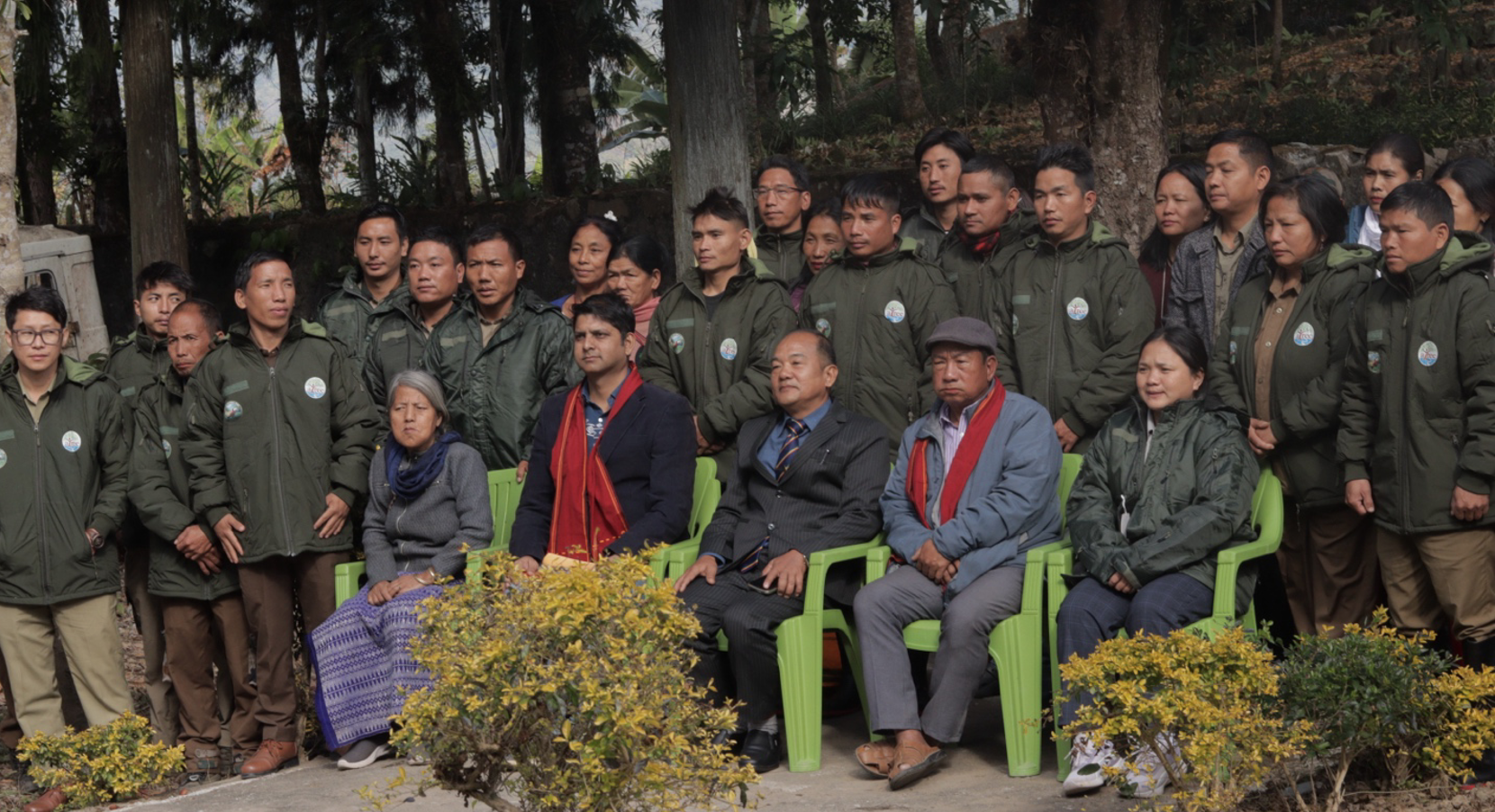
Safeguarding Mouling National Park and Community Forests of Siang and Dibang Valley
The Siang Valley in Arunachal Pradesh spans 18,518 sq km and harbors one of the most intact biocultural landscapes in the Eastern Himalayas. Despite 84% forest cover, only 7% of the forests fall under formal Protected Areas like Mouling National Park. ATREE's project focuses on the remote Mouling NP, community forests in Yingku and Yosing villages, and Dibang Valley.
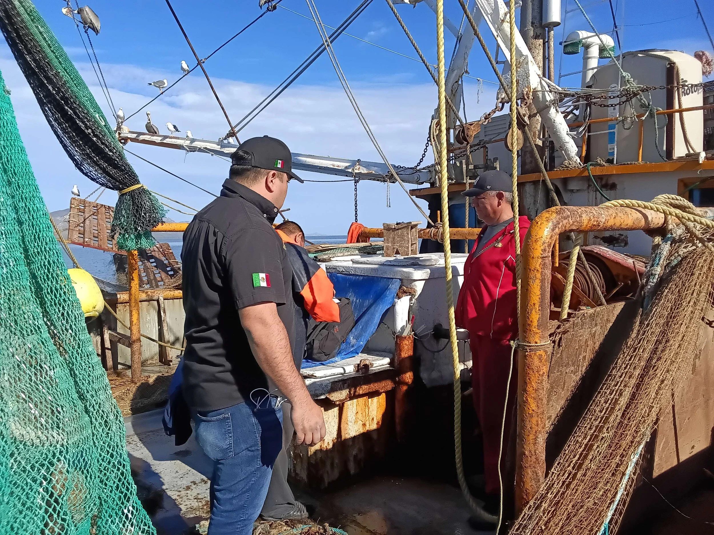
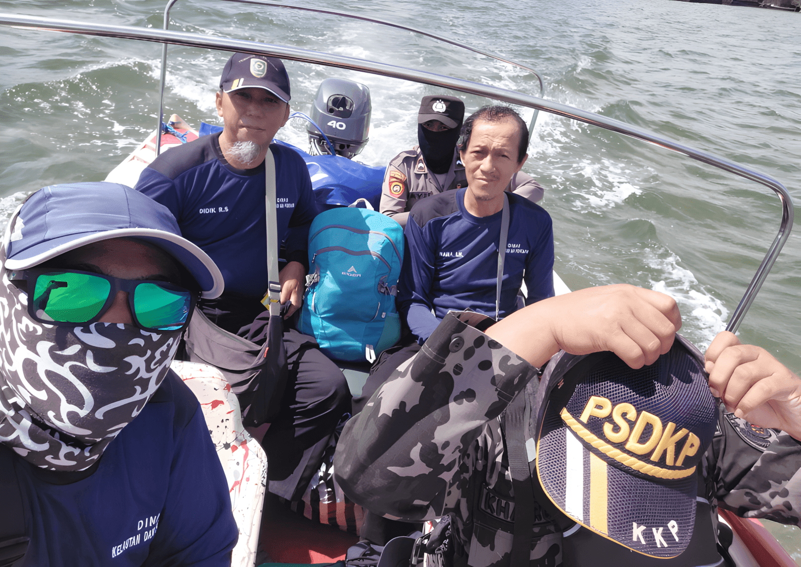
Upgrades Made for Global Park Defense for Marine Protection in Baja Sur, Mexico
Throughout the first two months of 2026, Global Conservation in Mexico has worked alongside our partners CONANP, CONAPESCA, and SEMAR to continue our projects and deploy new Marine Monitor systems on El Pardito Islet and in Espíritu Santo National Park, off the coast of La Paz Bay.
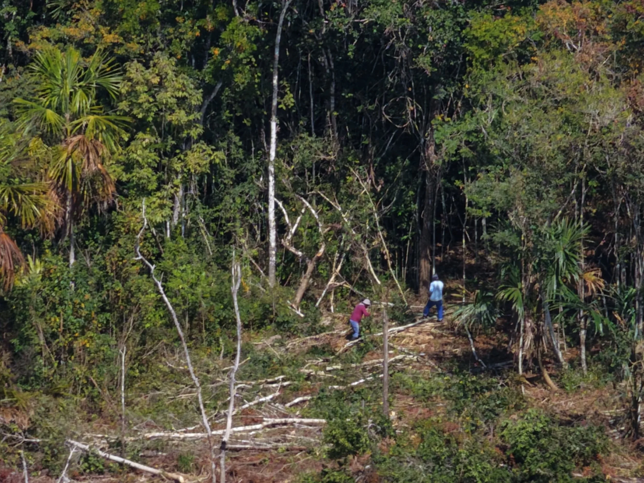
GC-Provided Drone for Calakmul, Mexico Patrols Starts Producing Results
Update: On October 31st, the President of the Congress of Guatemala and Congressman César Fion gave a formal recognition to the Genesis Elite Ranger Team and to me inside the Congress in Guatemala City.
GC Hero Farwiza Farhan Receives the 50th Anniversary Rolex Award
In a year resplendent with symbolism and substance, Rolex marks the 50th anniversary of its pioneering Awards program by announcing five extraordinary women as the 2026 Laureates, including our own GC Hero Farwia Farhan.
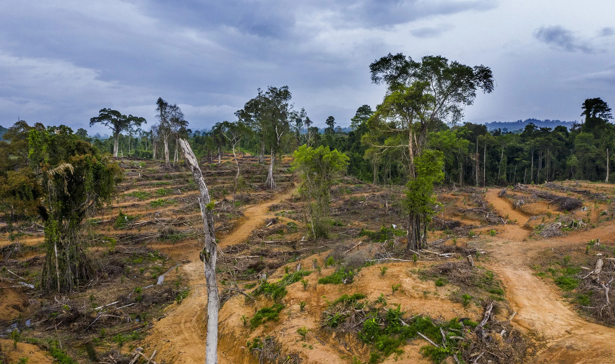
Protection of Bengkung Trumon Megafauna Sanctuary, Sumatra
The FKL Wildlife Protection Teams have made significant progress in safeguarding the biodiversity of the Bengkung Trumon Megafauna Sanctuary (BTMS) and the Suaq region from January to November 2024. Eight Wildlife Protection Teams conducted 88 patrol missions, covering 5,807 km, documenting vital wildlife presence through sightings, including 1,896 orangutans, 1,182 Malayan bears, 844 Sumatran tigers, and 221 Sumatran elephants. These efforts also dismantled 15 snares and documented 35 poaching cases.

GC’s Work in Calakmul, Mexico Appears as Finalist in National Prize for Scientific Journalism
The article “On the Trail of the Jaguar” by our friend Astrid Arellano is one of just three finalists for this prestigious national award. This comes after GC Partner Gerardo Ceballos and his team announced that Mexico’s population of jaguars has gone up by 30%, which currently is one of the only populations of wildcats in the world whose population is shown to be on the rise.
GC DaMaI Rainforest Complex, Borneo 2024-25 Impact Report
Two Year Planning meetings in Danum Valley with GC Partners, Yayasan Sabah, and Sabah Environmental Trust (SET) increase protection funding for 2024 for long-range patrolling and two new Ranger Stations in high-threat areas.
The Ngorongoro Conservation Area 2024-25 Impact Report
Global Conservation supports two conservation partners for the Ngorongoro World Heritage Site in Tanzania: African People and Wildlife (APW) and KopeLion. Regarding APW, we provide support to human-wildlife conflict mitigation officers, with a primary focus on elephants, while KopeLion focuses on developing a sustainable model for lion-livestock coexistence.
Derawan Archipelago Marine Protection: New Impact Report
Yayasan Laut Biru Kepulauan Derawan (YLBKD), in collaboration with Global Conservation (GC), continued to strengthen marine protection in the Derawan Archipelago through support for patrol operations, the deployment of M2 monitoring technology, capacity building for law enforcement, and initiatives focused on community empowerment and applied research.
GC Impact Report 2024-25: Enabling the Recovery of Murchison Falls National Park, Uganda
Since 2018, Global Conservation has been supporting the work of the Uganda Conservation Foundation (UCF) and the Uganda Wildlife Authority (UWA) to restore wildlife, develop effective park management, and drive up tourism numbers in Murchison Falls National Park, Uganda.
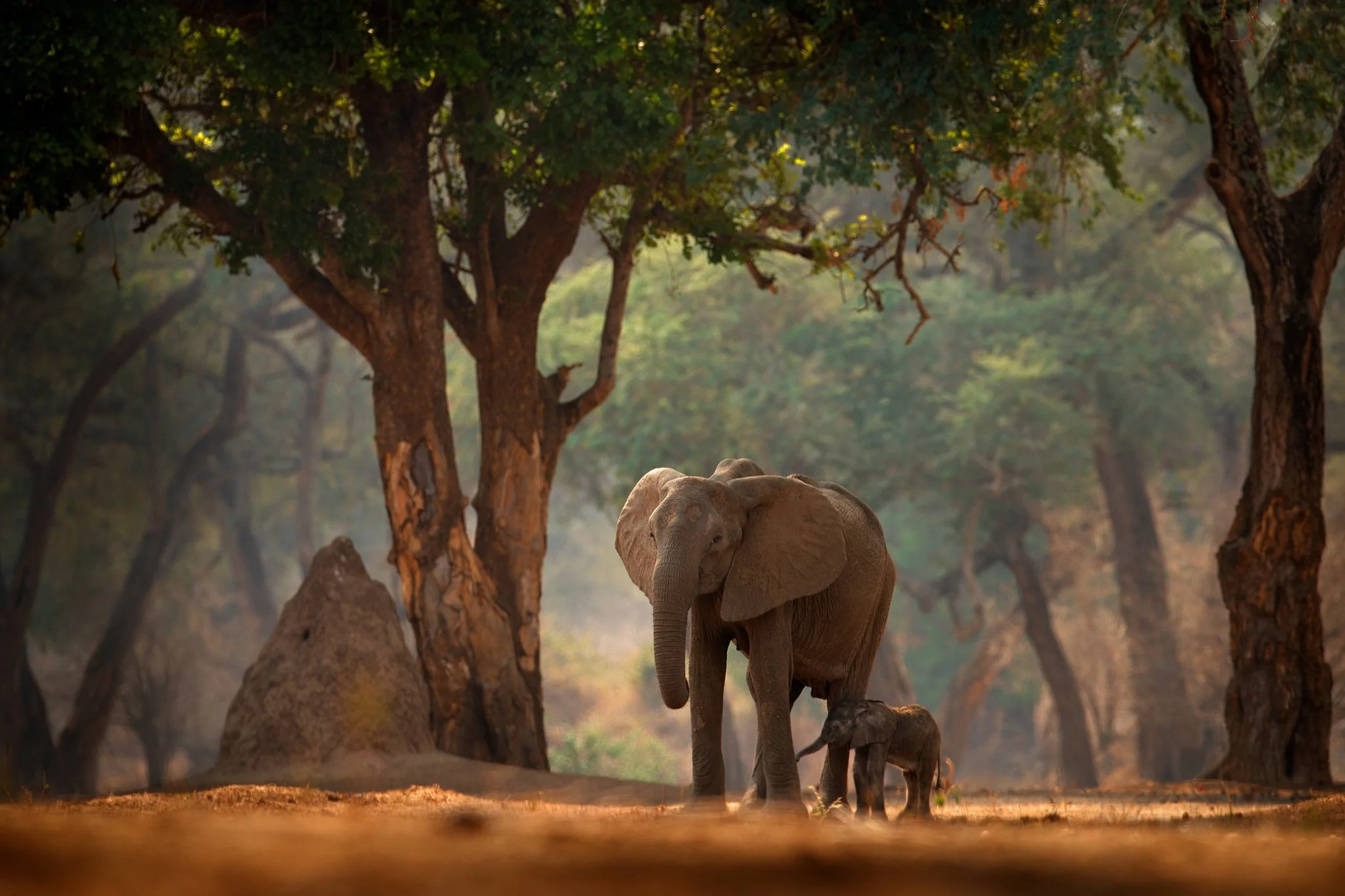
Mana Pools National Park 2024-25 Impact Report
With our support, the Bushlife Conservancy has been working tirelessly to curb poaching in Mana Pools National Park and the surrounding Zambezi Valley, Zimbabwe. Thanks to this hard work, they recently announced that Mana Pools National Park has been free of any elephant poaching incidents for six years.
Cameroon Impact 2024-25: Protecting the Dja Rainforest Complex Forest Elephants and Great Apes
Global Conservation focuses on Global Park Defense and Community Protection to help conserve the last African Forest Elephants and Great Apes in Cameroon's Dja Rainforest Complex.
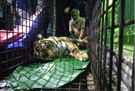
Saving Sumatran Rhinos, Tigers, Elephants, and Orangutans: The 2024-25 Leuser National Park Impact Report
The Leuser Ecosystem of Aceh, Indonesia, is one of Global Conservation’s most important National Park and Community Protection programs. Focused on the Bengkung Trumon Megafauna Sanctuary (BTMS), we are protecting over 1 million hectares of pristine tropical rainforests – the Last Place on Earth where tigers, rhinos, elephants, and orangutans coexist in the wild.
Join Us
Become an integral part of our mission and make an impact on your world today. Click below to find out how you can make a difference.